A walk through the mountains ending in a long downhill path.
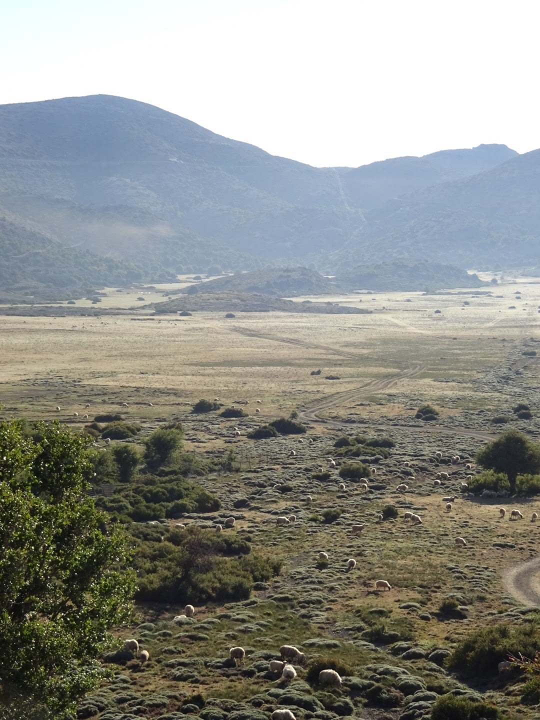
An avian choir woke me early so I packed up and decamped while the sun was still below the mountain tops. The snow on which I was pitched was soft and crystalline yesterday, this morning it was hard, icy and slippery. The rocks I had placed on the pegs to keep them secure had become iced into position, I used another rock as a hammer to free them. I had to carefully pick my way down the valley over rocks and thorny bushes. High above me a shepherd was already herding his sheep, and they were making faster progress down the mountain than me.
At the bottom of the valley there was a small family church, some informative signs and what might one day be an information centre. Beyond all that was the Nida plateau, a flat area of grazing land. It was here I saw a goat grazing on the top of a tree, the tree's stunted shape, trimmed by the goats, had made climbing up it easier for these animals.
My way led along a dirt road, out of this plateau and into a series of smaller flat areas. Each of these was surrounded by higher ground, the track climbed out of one and descended into the next, there was no river draining them, it was a feature of the limestone landscape. On these flat areas there might be a pick up or two, a small building, a fenced area, and sheep being corralled and put in the back of pick ups.
The dirt track ended and the route followed a "path". As I was beginning to expect, the path was difficult to spot. The one I wanted headed around the mountain. I followed the route on my GPS among the rocks, trees and thorny bushes. It led me to the top of a steep, rocky drop. I needed to get down but it was difficult to see how. I scrambled down the rocks a little but due to the convexity of the slope I was unable to see if there was a sheer drop beneath me or not. Recalling the advice I received on a scrambling course at Plas y Brenin I followed a route marked by brown staining on the rocks. The brown staining on the rocks could have been caused by mud carried on the boots of people before me, or it could have been mud carried by goats. In the event it led me down to the more gentle slope below, however I would not recommend others to come the way I did, although I was always close to the route I downloaded, and a footpath marked on the Greece Navitracks map on my GPS. It may be that the route I had was outdated, as some red markings and a sign I later came across suggested an alternative had been developed from the Nida plateau, to the north of my route on vehicle tracks.
The path joined a dirt track and then a gravel road cut into the rock which took me around a great bowl in the mountains. Above was mainly naked limestone, below, what passes for a forest in Crete composed mainly of holm oaks. I could see an eagle circling. The E4 route across the Psiloritis mountains that I was following was probably not the most popular. An alternative took you down to Zaros. Both routes joined at a point where a path heads up to a pass at some 1700 metres. Again the word "path" was a misnomer, I just had to pick a way through the rocks, thorn bushes and, lower down, trees, up a valley in the general direction indicated by my GPS. In places steep rock outcrops required some thought on how to get around them. As I climbed higher there were occasional waymarks, red stripes or spots, or E4 signs on posts, usually positioned high up on rocks. At first I thought the path went close by the E4 signs, but in many cases the path was a many metres lower down, the sign cemented into a high rock presumably so it could be spotted from a distance.
On reaching the pass at around 1700 metres I thought I would have enough time to get down the other side to some accommodation at Kato Asites and phoned to make a reservation. I was finding the steep, rocky and thorny slopes of Crete made it difficult to find a good camping spot, making a more conventional bed desirable. However having reserved a room I felt under some pressure to get there at the agreed time. The distance was not great but the path was very, very slow. It involved descending some 1200 metres in a short distance over a rocky landscape. Loose or wobbly stones meant you have to take it slowly and carefully, and my feet were complaining about all the hard work they had been made to do in the last two days. I was glad I had stiff boots as even with these the soles of my feet were feeling the rocks trying to push through my soles into my feet. Towards the bottom I was getting frustrated with the interminable descent. The first milestone was a refuge, but the more gentle slope it occupied did not last long, there was a steeply dropping gorge section ahead, fortunately with some helpful waymarks and a slightly clearer path. While the descent was frustrating, this is not to say that the scenery, the limestone outcrops and flowers were not attractive, even beautiful. I was nevertheless relieved to walk into the village of Ano Asites, and hence to its sister, Kato Asites, where I am staying at the spacious Asion Lithos apartments, where I received a welcome discount for having read about it in the Cretan Way guidebook. A shower, a beer and dinner greatly improved my mood.
29.8 kilometres walked today, with some difficult terrain, and a total ascent of 800 metres, although the total descent of 2250 metres was the more painful.
 |
| Nida plateau |
 |
| Rouvas forest |
 |
| Rocky path doen to Ano Asites |
No comments:
Post a Comment