Friday, May 31, 2019

Kallikratis to Argiroupoli on the E4: Day 73

An unexpectedly local breakfast, and some interesting water features were plus points today, somewhat offset by having to retrace my steps at one point due to being unable to find a viable path.
Camping in sheep country, in which many of the sheep have bells around their necks, meant that periodically in the night the noise of jangling bells came close to my tent before receding. It seems that at least some sheep graze at night and sleep under a shady tree during the day. Not a bad idea with their woolly coats.
After decamping and passing a nearby church, I walked a few kilometres down into Kallikratis. Shadows cast by the low morning sun, picked out in high contrast the detail of the trees, houses and plots of land in the village, against a backdrop of stony mountains. However it did not look like there was much in the village, so I was very pleased to find at 7:10 am in the morning an open cafe. I ordered a Greek coffee, and the proprietor (an unshaven grey haired man with a moustache) said "feta?", to which I said yes. So I had a breakfast of feta cheese, dressed with olive oil and some bread. The feta was a fresh, soft and crumbly variety and the proprietor indicated it came from the two goats in the small field opposite which he proceeded to feed. As I sat eating my cheese the occasional battered pick up passed by with a plastic churn of milk, white or brown, either from freshly milked goats or sheep as there were no cows in the area. A flock of sheep gathered on the road nearby, two of the sheep were having a head butting competition. On a gate being opened the well trained sheep went through it, I saw no shepherd or sheepdog organising them. Whether it was for milking or feeding I don't know.
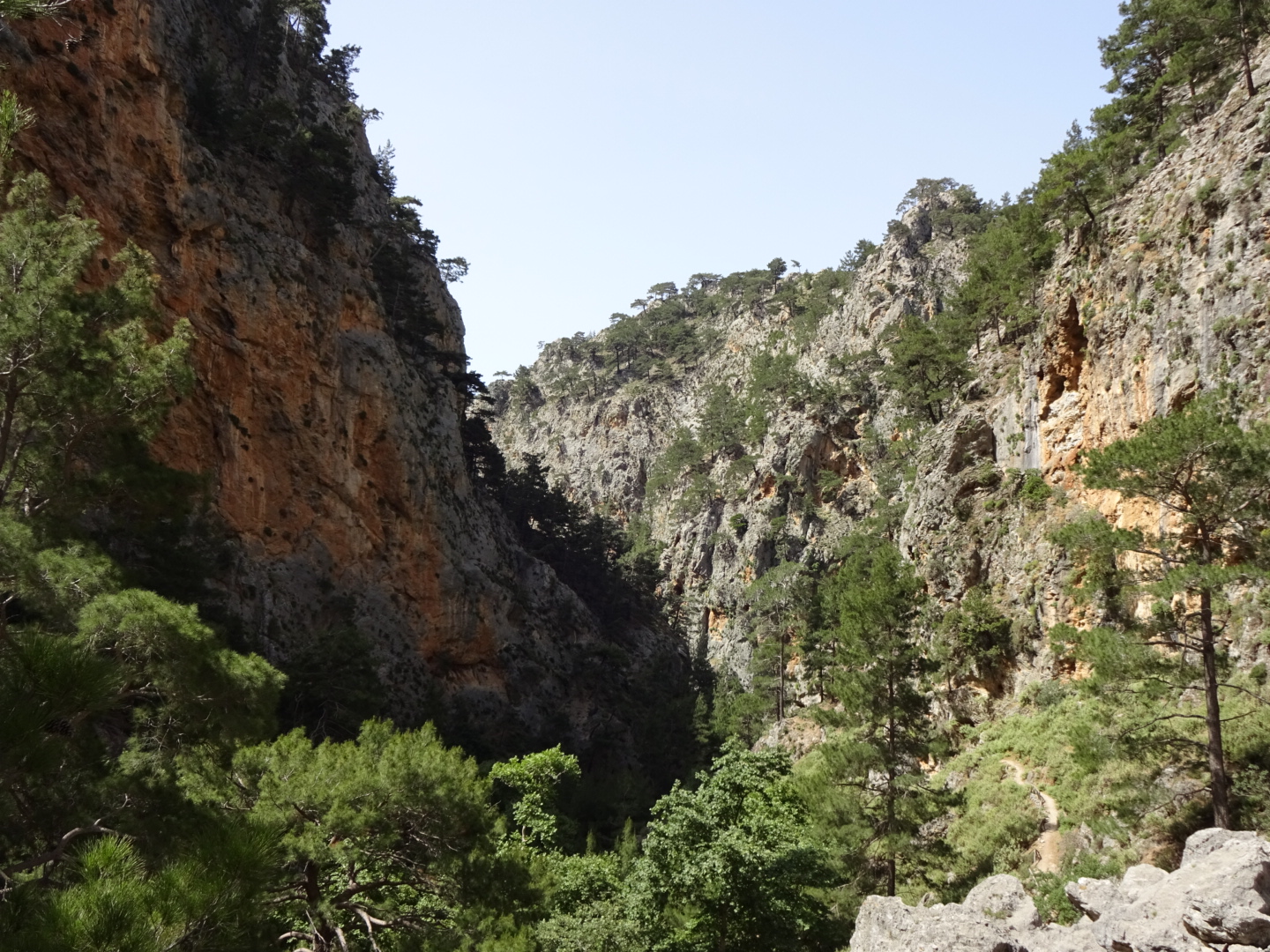
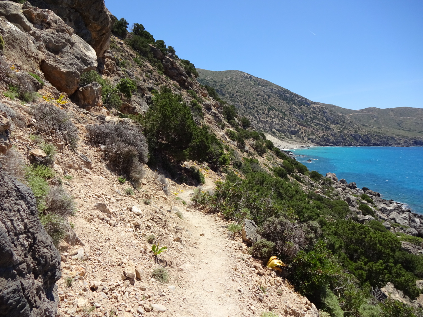
Leaving Kallikratis I followed the E4 up a hill, through one of the many Cretan fences, and down the other side onto the road to Asi Gonia. To reach the bottom of a steep mountainside, the road had numerous hairpin bends. It was possible to cut off some of the loops on what the map claimed to be paths, but it was more enjoyable walking down the road admiring the view than looking down on every step to carefully place my feet among the rocks and thorn bushes on a "path". At first I thought I was going the wrong way as the sea was in the wrong place, but then I realized I was looking at the sea to the north of Crete and not the Libyan sea to the south which I had been walking beside recently.
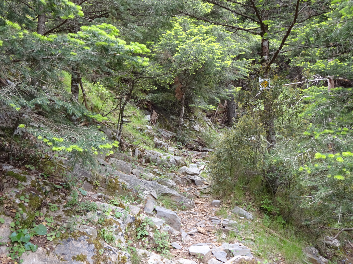
Asi Gonia also had an open cafe where I had a Coke and cake before following my GPS route along a narrow road which became a gravel track. After a few kilometres the GPS indicated that I should head downhill to join the Asi Gonia to Argiroupoli road. I plunged through an overgrown olive grove to where I thought it should be, and after trying a few routes, and then having to climb back uphill I spotted two red stripes painted on a rock, similar to those used to mark the E4 elsewhere. First I had to negotiate the rebar fence, which seem to be everywhere in Crete. Then I had to try and find where the trail went. I found one or two of the red waymarks but not enough to work out where the path was then meant to go. My best guess was along the base of a ravine, but it was too overgrown for me to make any progress. So I was forced to return to the gravel track. To reach it I scrambled up some rocks on a steep slope, not so easy with a rucksack, and disassembled (and then reassembled) a bit of fence, not nice. Then it was a lengthy walk back to Asi Gonia before following the road route to Argiroupoli.
I marched along the road, down a steep sided valley, pretty quickly and arrived at the bottom of the hill on which Argiroupoli is built. On climbing the hill I passed coach parties of tourists. There is a natural spring which a string of restaurants have used to good effect to create water features for their customers who sit under trees, cooled by the water, eating trout. The trout seemed to be kept alive in sections of the water feature so you could be really sure of having fresh fish.
I struggled up the hill to the village, walked past some tourist type shops and a second or third century mosaic (needing a bit of a clean) to my room for tonight in Maria's rooms. Unhelpfully it does not say this on the sign outside but an older man, who spoke little English, assured me the rooms were indeed Maria's and took my passport details.
Later it was grilled vegetables and souvlaki in a restaurant with a goat statue spouting water.

I walked 29.9 kilometres including my effort to find the path with a 600 metre total ascent, if I had stuck to the road after Asi Gonia, I would have walked only 24.1 kilometres with a 390 metre total ascent.

Fields around Kallikratis

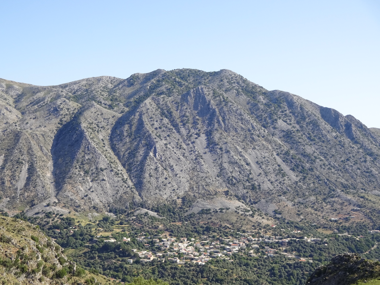
The village of Asi Gonia below a stony mountain

Thursday, May 30, 2019

Hora Sfakion to Kallikratis on the E4: Day 72

Today's highlight was the walk up the Imbros Gorge, a more intimate experience than the Samaria Gorge.
At breakfast on the seafront at the Livikon hotel, I listened with admiration as the waiter switched between four languages as he addressed different customers. Suitably fed, I climbed up the road out of Hora Sfakion. Ignoring a possible detour, as it involved extra climbing in an apparently unattractive area, I followed the road, passed various cafes with adverts for taxis, to the entrance of the Imbros Gorge.
Given a loose interpretation of where the E4 goes, I had a choice of three routes, up the Imbros, Astendiano or Kallikratis Gorge. Based on guidebook recommendations I selected the Imbros, although as I later discovered it would involve a bit more climbing. Although nowhere near as popular as the Samaria Gorge, it still attracts a fair number of people who pay 2.5 euros to walk around 11 kilometres through this smaller gorge. The gorge is narrower than its bigger brother, in places you can simultaneously touch both side with your hands while the cliffs each side rise vertically above you. There is also a natural arch. With no water in the gorge today, the walking was not difficult, much of the path is flat although there were a few places with rocks and pebbles to negotiate. The cliffs each side and some trees provide a degree of shade except at each end.
At the top, in Imbros village, I had a lemon drink and ice cream at one of the tavernas before tackling the next stage of today's walk, a road section to Asfendou. Over a few kilometres the road climbed 320 metres at a steady pace. There was no shade, the vegetation was the low thorny type that covers much of Crete. The sun was out and sweat was coming into my eyes, making them sting. Once the road reached the pass, it promptly lost all the height it had gained as it dropped down into Asfendou. I was happy to see an open taverna in the village to refresh myself with a cold Coke. It was pretty hot and after the village I noticed, not for the first time, a flock of sheep huddled under a tree for the shade.
A kilometre or so later I could either continue along the road to Kallikratis, or reach the village by a longer route on tracks and a footpath up in the hills. I chose the later as the accommodation I had been considering at Kallikratis was full, so I was planning to wild camp. So far I had seen no camping opportunities near the road, which had been cut into a rocky slope. I thought more favourable and discrete options would be found off the quieter mountain track.
So I followed a vehicle track among grazing sheep and goats, then a barely visible path which I could only find with the continuous use of my GPS and the track I had obtained from the Cretan Way.
Finding a clear patch of flattish ground among the rocks, a few kilometres short of Kallikratis, I chopped down thistles and other things with needle sharp thorns to make a site for my tent. Removal of the thorny things was difficult as they easily penetrated my leather gloves, as well as the fabric of my tent's groundsheet.
After dinner of a cheese and vegetable pastry pie purchased from the bakery this morning, and an apple, I headed into my tent as the insects were starting to bite.

26.2 kilometres walked today with a healthy ascent of 1480 metres.

Imbros gorge

Imbros gorge

Wednesday, May 29, 2019

Agia Roumeli to Hora Sfakion on the E4: Day 71

A walk along a coast path with some exciting bits.
Today's walk along the coast was almost entirely on a footpath, apart from a short road section near Hora Sfakion. At times it was along pebbly or gritty beaches, at others among pines, sometimes over rocks and the remaining time among the low vegetation, adapted to limited amounts of water, that characterises much of Crete. Much of it was very attractive, the path squashed between the mountains on one side and the sea on the other. The first sight of interest was St Paul's chapel, where St Paul was said to have baptised the first christians on Crete. As it was next to an isolated taverna I stopped for a coffee, the men I had met earlier sporting "20 × E4" tee shirts were already there, playing cards and fixing boots with duct tape.
My approach to the village of Likos (which I mistook for Loutro) was the next bit of excitement. The path down to it follows a ledge on the cliff that was not that wide, although, as I did not look down, I am not sure how much of a drop there was. After a lunch of peas and artichokes at a cafe at the start of the little settlement I continued (through the middle of other tavernas) to Loutro.
There must be some kind of local regulation because all the buildings in Loutro had white walls and dark blue fittings. Even the beach umbrellas and the restaurant chairs and tables were dark blue and white. Only some yellow plastic canoes jarred with the theme, and a few houses that used the wrong shade of white or blue.
A few bays later the curve of Sweet Water Bay appeared with its array of sun loungers and umbrellas. At the east end of the bay, the E4 seemed to have suffered from recent rock falls, and even on the sandy part of the beach I am not sure I would be that happy about sitting around on a sun lounger, the cliffs and steep slopes above looked a bit unstable. After the zone of recent rock falls, the E4 was along a recognizable path paved with rough rocks over older rock falls. Ahead though the path seemed to be cut into the cliff with a large drop to the sea on one side. For most of the day, as far as Sweet Water Bay, I had frequently met walkers coming the other way, but in this section it was just me. It made me a little concerned, as looking ahead, it seemed that one bit of the path on the cliff was missing, and I was not planing on risking any heroic rock climbing over damaged sections of path. I considered catching the water taxi service rather than completing the walk, but there were no reports that the path was impassable. Provided I was happy to retrace my steps there seemed no reason why I should not continue to see if it was possible to safely pass the questionable section. As I progressed it was apparent that a good path had been cut into the cliff at some point in the past, with bits of concrete being added at a later date. The section I thought was missing was intact, and although I was careful not to look at the drop beside me, I fairly easily negotiated the E4 to where the path terminated at a bend in the road.
Once on the road I soon marched to Hora Sfakion and the Hotel Livikon. The man who was to show me to my room joked that it was a 30 minute walk away, after 7 hours walking I was not amused. My room is in fact directly behind the seafront, and from my balcony I watched as hundreds of tourists disembarked from the ferry. They were from tour groups walking down the Samaria gorge, brought by sea from Agia Roumeli, to the coaches waiting near my hotel. A quicker than walking my 7 1/2 hour walk, but not quite so exciting!
Near the harbour there was a memorial describing how thousands of soldiers were evacuated from Crete at Hora Sfakion during the second world war. It made interesting reading.

21.6 kilometres walked today with a total ascent of 725 metres.

The white houses of Agia Roumelia dwarfed by the size of the mountains behind it
Path squashed between the mountains and the sea

A tricky section of path which goes in front of the cave

Perfectly coordinated Loutro

Tuesday, May 28, 2019

Omalos to Agia Roumeli on the E4: Day 70

Today I walked down the famous Samaria gorge, with many others.
I was down for breakfast at 7:15 am with one other guest. Shortly after two coaches arrived and suddenly the restaurant was full of people queuing at the counter to collect their breakfast or sitting down to eat it. The staff had it all organised for a fast turnaround. While I went upstairs to pack, everyone left (for the Samaria gorge) and the restaurant was again empty when I returned to pay.
I battled a strong headwind as I hiked the 4 kilometres from the hotel to the gorge's northern entrance, following a straight farm track across the plateau most of the way to avoid the road.
I began my walk down the Samaria gorge at around 9:30 am with I think the last of the coach parties. On the initial steep descent it was pretty crowded, but people became more strung out as the kilometres progressed so that at one point I could see no-one and began to wonder if I was in the right path! Some of the people had clearly not been hiking for a while and were moving very hesitantly  down rocky bits, I hoped they would make the bottom as there was no other option. As you might expect for such a popular walk, a lot of effort had been made to create the path, with wooden railings next to drops and some crude wooden bridges. However, there were still places with boulders, and several crossings of the clear, fast running water in the gorge on carefully placed stepping stones.
The first part was through pine trees and pleasant enough, the most spectacular sections came later with huge cliffs each side of the narrow gorge making people look really small and insignificant. These areas were more crowded as the people coming down slowed to admire the beauty and were joined by others now coming up from the bottom entrance. People's brightly coloured clothing contrasted with grey or brown rocks.
I celebrated reaching the end of the gorge with an ice cream and then walked down the road into the tourist village of Agia Roumeli to my hotel, the Agia Roumeli Hotel. Once the coach parties had left on the ferry the town was quiet, more restaurants than people it seemed. A lugubrious looking fish for my dinner tonight.

20.4 kilometres walked today, mostly downhill.


Monday, May 27, 2019

Sougia to Omalos on the E4: Day 69

A walk between the high walls of the Agia Irini gorge, followed by a climb up the steep Figou gorge to the Omalos plateau.
From Sougia there are three alternative E4 routes: one along the coast, a second by the mountain of Psilafi and a third up the Agia Irini gorge. Descriptions in guide books, and a wish to go down the Samaria gorge tomorrow, caused me to choose the third option.
After a pain au chocolat and coffee at a nearby bakery I left the Lissos rooms as spots of rain were falling. Thankfully the rain stopped after a half hour or so and later the sun shone. My GPS said to head up the stream bed of the water course that lies at the eastern end of Sougia. I stumbled over the rounded stones and boulders, or followed transient tracks on adjacent areas of sandy soil populated by pines and pink flowering shrubs. There was no water but damage to roads I came across suggests there were some high flowrates in the recent winter.
After a concrete bridge I sometimes walked on the road, which was easier, and sometimes on the stream bed. The quiet road terminated at a car park and cafe (where I enjoyed a homemade lemonade) that marked the beginning of the gorge. From here the route was marked with blue or red paint. Sometimes there were paths on one side of the river or the other, sometimes you walked on the rounded pebbles in the stream bed. It was wise not to miss the painted markers when they took you off on some path, as following the stream bed all the time would mean climbing over large boulders, which would require some technical skill. On a few occasions a search was needed to work out where the painted markers had gone to. In places there were steps and railings, crudely constructed. There were also some picnic tables under the trees and taps for water. Trees were clinging to the walls of the gorge which were much higher than I expected. Looking up to see the top of the cliffs was difficult as I was liable to trip over some rock. In places the path zig zaged up the slope to go around areas of huge boulders. Quite a few people were coming down the gorge but for most of my trip I was alone and could see no-one.
Near its top, where water was now tinkling over the stones, I left the Agia Irini gorge and headed up the Figou gorge. This had a much steeper gradient, the path frequently changing direction as it gained height, passing a group of goats at one point. As I sweated up a lady said I was near the top, she lied (maybe to encourage me?). When I finally reached the top of the Figou gorge, there was an old, but well constructed mule track which led me up to the road. There were even a few benches on which to rest.
Once on the road I soon reached the Omalos plateau; a flat, farmed expanse, surrounded by mountains. The grass looked green rather than straw coloured as it did nearer sea level in my walk through Crete. A more relaxed walk along empty roads then took me to Hotel Gigilos Omalos. Actually a taverna with rooms attached, of which there are a few here.

19.7 kilometres walked today with an ascent of 1210 metres.

The Dragon Arum, a dramatic looking plant found in the gorge which has an unpleasant smell

The Agia Irini gorge

Omalos plateau

Sunday, May 26, 2019

Camping Grameno to Sougia on the E4: Day 68

Today's section of the E4 was particularly beautiful, and many people were walking along it.
From Camping Grameno I followed the road into the town of Paleochora, a road made particularly dusty by some pipe laying works beside it. I was somewhat apprehensive as I was having problems with my Debit card when I tried to use it at the last three guesthouses. The card readers were indicating a connection error and the bank suggested the card may be damaged but to try again. I had another card with me but shortly after I began this trip its issuer decided to cancel my existing card and send out a more secure replacement, sent of course to my home address. I was therefore very relieved when my card worked in one of the town's ATMs and I withdrew as much cash as possible. To celebrate I had a breakfast of "yoghurt with fruit" and a cappuccino, the bowl of yoghurt was large as was the variety of fruit, and it came with a free bit of cake! (I have noticed in Crete you often get free extras, like some raki). Suitably pleased, I climbed up to the ruins of the Venetian castle at the point of the peninsula. Not much is left but the tower is a great viewpoint.
Heading out of town (initially on the wrong road as my thoughts were distracted by the places I was walking past), I followed a small road and then a gravel road by the sea. There were people walking ahead of me, a couple with matching red shorts and white tee shirts, I imagined them on a romantic holiday. I found myself trying to keep up with them, which was very silly, it is not a competition, so I stopped and put some purchases I had made at Paleochora in the correct places in my rucksack.
The gravel road led to Gyaliskari, which is a sandy beach with a cafe and beach umbrellas. In planning this trip I had imagined myself stopping at some beach I passed and having a swim. As I had plenty of time today there seemed no excuse not to, and the sea did look inviting, being very clear and blue. So I struggled to put on my swimming trunks under my miniscule camping towel (I later  discovered at the far end of the beach they had dispensed with swimming costumes so I could have saved myself the trouble). I did manage to swim for a bit longer than yesterday and then used the beach's shower to wash off the salt water. One "wild forest" smoothie and avacodo toastie later I was back on my way, behind a party of German ladies. I overtook them when they stopped for some selfies. After the beach the path was over rocks and rocky landscape, all very scenic. I passed a group of men who had tee shirts saying "20 x E4". As I understood them, one of their number was walking this part of the E4 for the twentieth time, impressive!
The path went into a steep climb as it crossed a headland, before dropping down to Lissos on the other side. Lissos is a place with a secluded beach and some ancient ruins. Bits of an amphitheatre and the walls of a building with a mosaic floor were the most obvious remains, and a small Orthodox church from some more recent period  with some old wall paintings. According to the sign the place used to be very important in ancient times, issuing its own coins.
There was then another climb as the path scrambled over rocks, above some steep slopes, followed inevitably by another descent. The descent took me into a gorge of unexpected beauty, a great slab of rock curving above it, shrubs with red flowers decorating the dry gorge bed.
A harbour was at the end of the gorge, and a short road took me to Sougia and the lines of restaurants behind the pebbly beach. One of them offered zucchini flowers, a favourite if mine, but after I had settled at a table I was told they had run out. I am now in the Lissos rooms, one of many places offering rooms for rent.

20.6 kilometres walked today with a 600 metre ascent on a fairly slow path.

View from Paleochora castle looking east over part of the town and the coastline the E4 follows

Ancient ruins at Lissos

The short but impressive Sougia gorge

Saturday, May 25, 2019

Chrisoskalitisa to Camping Grameno on the E4: Day 67

A more arduous day than I expected walking close to the sea through vegetation, over sand dunes and up rocks.
Between Chrisoskalitisa and the next settlement of Elafonissi the E4 officially follows the road but a more adventurous, alternative route has been devised. This begins on a vehicle track but soon diverts onto a path marked with two red stripes. For much of the walk the path is difficult to spot as you push through low bushes, some of them thorny, releasing a scent of thyme. In several places I lost the red markings and the mixture of large rocks and bushes made it difficult to find a way forward. The rock was a breccia (i.e. it had angular bits of rock of various sizes embedded in it), I thought there might be some volcanic association, certainly it was rough enough to give my boots a good grip. However the spacing of the rocks on this section meant they were often an obstruction rather than an aid, being too widely spaced to jump between. After much effort I reached a bluff. I climbed down, negotiated a typical Cretan rebar fence and reached the start of Elafonissi beach. A naked man discretely sunbathing under a tree marked the outer perimeter.
The beach was a complete contrast to the area I had just crossed. Coaches were disgorging people who joined many others sunbathing on the white sand by the turquoise blue sea. Bars offered drinks, there were sunbeds and umbrellas, an air of hedonism prevailed.
Leaving the beach E4 signs and yellow and black stripes directed me over rocks a little way, passing a boat load of tourists. Beyond the rocks the E4 went through, according to the sign, a rare ecosystem of sand dunes and juniper trees. Very pretty but the sand made for slow going. I continued on sand or rock past a few small beaches. Unlike Elafonissi beach, only a few people were enjoying them, maybe the longer walk from the nearest car park discouraged others.
Then there was a section involving climbing up rocks and traversing steep slopes which took me to a bay where a sign described some Roman remains. I could not see any although didn't look long, maybe there was more to see if you went snorkelling in the clear sea.
After climbing up and over a headland the E4 left you on Krios Beach, where the taverna at which I hoped to refresh myself was closed (although I found a cafe on the road a kilometre or so later). Moving onto the coastal plain I walked past acres of "greenhouses" made of plastic sheeting. Inside were lines of tomato plants, the fruit in various stages of ripeness.
I decided to spend the night in Camping Grameno a few kilometres short of the town of Paleochora. My choice was in part because the site is beside a beach and I fancied a swim in the sea having seen so many enjoying it on my walk today. A cold wind was blowing once I had pitched my tent and the sea was cold, so my bathing was extremely brief! Sometimes the idea of something is more pleasant than the actual experience. However the beer, chicken in lemon sauce with rice and Greek salad at the campsite bar afterwards more than matched my expectations.

20.2 kilometres and an ascent of 520 metres covered today.


Friday, May 24, 2019

Berpathiana to Chrisoskalitisa on the E4: Day 66

A bit of extra walking as I went down, and then back up, the Kabou gorge.
Things did not get off to a good start. I agreed the previous evening that the room would come off my credit card, but in the morning a different lady wanted cash. Language difficulties made things a bit difficult and I am sure she thought I was some disreputable character who was trying to avoid paying. In the event she took almost all my change. This meant that in the heat of the hot day, when I tried to buy an ice cream with a 50 euro note, the guy serving was not at all happy. He eventually found the change in one pocket or other, perhaps I should just have suffered and done without.
After the payment problems I headed off down the attractive Kabou gorge. Signs started from just by my guesthouse and took me deep into the gorge, among the rocks and trees on a reasonably good path (despite an overgrown section at the beginning). I exited the narrow valley with a view of a pebble beach. Then I checked my GPS and realised I was not in the valley I thought I would be. I should have been in a valley to the south. I faced a choice, either try and walk south across the headland or walk back up to the top of the gorge and start again on the right route. Although one of my maps showed a path across the headland, I saw no sign of it. I could have pushed through the low vegetation but I was concerned about the outcrops of rock and the likelihood of cliffs on the other side. Probably I could have found a way through, but the risk of having to turn back meant I took the more reliable alternative of climbing back up the gorge and starting again. 7 kilometres and a 330 metres climb was added to my day as a result of this excursion, although not entirely wasted as it was an interesting, if not spectacular walk.
Officially the E4 follows the main coast road to Chrisoskalitisa - not at all a good hiking option. Instead I followed a smaller road through the village of Livadhia and closer to the sea. This should have a much quieter route, but the main road was closed for repairs after damage caused by winter rains, so a fair amount of traffic was diverted onto the small road I was following, mainly tourist rental cars before Livadhia, then pick ups taking tomatoes to market afterwards. Initially the scenery near the coast consisted of olive groves, set against a mountainous backdrop. Later the road was close to the sea and I walked by rocky seashore and some deserted, if pebbly beaches. The final short section of the walk was on the busy main road with tour buses passing. Chrisoskalitisa itself is a tourist place with multiple tavernas offering rooms. I am booked into the Kochilas rooms, a fairly random choice.
The main sight is the nearby monastery. I thought its church quite plain. If my memory is correct, the churches in Northern Greece seemed to have been much more highly decorated than the ones in Crete and the Peloponnese. It was different centuries ago when the monastery had golden steps, sold to pay Ottoman taxes, although the faithful can maybe still see one.
Fresh fish for dinner for the second night running as I am on the coast, and very nice too....

Excluding my trip down the Kabou gorge I walked 17 kilometres today with a total ascent of only 220 metres, the Kabou gorge diversion added 7.2 kilometres and an ascent of 330 metres.

A GPX file of my route can be found on wikiloc.com or can be downloaded to your phone using myViewranger, short code johnpon0043.

Empty beach

Typical Cretan Rebar fencing

Church at Golden monastery

Thursday, May 23, 2019

Kissamos to Berpathiana on the E4: Day 65

A detour off the E4 to walk up the Sirikari gorge and a visit to an archaeological site.
Somewhat reluctantly I left the Elena Beach hotel at around 9:00 am having on arrived a little after midnight. Walking through the busy town of Kissamos was a little difficult due to the cars parked on the pavement but I soon reached the quieter road the E4 followed out of town. A person on the roadside pointed it out without being asked, perhaps my huge rucksack was a clue as to where I was going. The road took me uphill through olive groves for some seven kilometres to the village of Polyrinia. There was a turn I could have taken to cut out some of the road walking but I only spotted it later on a tourist map.
Polyrinia was a major fortified city in ancient times and a few walls, stones and the like still exist, although some of the masonry had been recycled in newer buildings. There were also some Venetian arches from later periods. At an information centre come coffee shop I enjoyed some apricot cake (donations for the coffee and very nice cake go in a blue box). The lady providing it told me about the three months of rain and thunder storms that had devastated the area over the winter, washing away bridges and sections of road. I later saw a complete section of roadway that had collapsed, closing the route to cars. It was yet to be repaired but I managed to walk across the landslipped area. There was a walk around the archaeological site which I completed. While I did not see a lot of archaeology the flowers hiding the overgrown path and the views back to the sea were lovely.
The E4 officially continues on (quiet) roads for a few tens of kilometres but it seemed to me there were better alternatives. So from Polyrinia (after a depressing drop in height) I went up the Sirikari gorge, a route described in the Rother walking guide to Crete. It was a good path between the bare, steep sides of the gorge. The river itself, falling over rocks in its bed below the plane trees, looked refreshingly cool.
Instead of climbing up to the village of Sirikari, I veered to the west, joining a road for few kilometres past a couple of churches. Leaving the road it was then a vehicle track, initially through woodland including a plantation of chestnut trees. As I gained height I lost the trees, the track sweeping back and fore through low vegetation, scarring the hillside, as it climbed up to a pass. The pass was marked by a line of wild turbines, turning at a good pace in the wind that was concentrated by the saddle between the hills. On one side I could see the sea to the north and on the other a rapid drop to the sea to the west of Crete. Then it was downhill, back into the trees. A lot of fencing had been erected using rebar posts and the wide steel mesh also normally used to reinforce concrete. Gates were made of a section of mesh tied onto the posts with rope or twisted wire that I had to untangle to get through and then make good again to keep the gate up and closed. It's not an ideal arrangement nor I think is it likely to last. I assumed this effort at fencing is to keep the goats or sheep in a particular area without needing a goatherd or shepherd to follow the flock around, as they do in much of Greece. Probably a less expensive way of looking after your animals.
At length I reached the Lefteris rooms (to a complimentary shot of raki), with my right ankle complaining. My room is clean and freshly painted, the first time it has been used this year. A group of three French hikers are also staying here, they have been walking the E4 in Crete in the opposite direction to myself. A big fish for dinner at the owners recommendation. My request for a glass of white wine was interpreted in a generous way and my eyes are now rather heavy....

26.1 kilometres walked today (excluding my walk around the ruins at Polyrinia) with an ascent of 1000 metres.

A GPX file of my route can be found on wikiloc.com or can be downloaded to your phone using myViewranger, short code johnpon0043.

The flowers at Polyrinia were more impressive than the ruins

Sirikari gorge

Road completely wiped out by heavy and persisitant winter rain

Wednesday, May 22, 2019

Gythio to Kissamos on the E4: Day 64

A ferry journey to Crete watching the sunset over the island of Kythira.
The Peloponnese section of the E4 European Long Distance Walk ends in Gythio, where a ferry leaves once a week on a Wednesday afternoon, sailing to the island of Kythira, and then on to Kissamos in Crete where the E4 continues. I managed to time my arrival at Gythio for a Tuesday evening ready for the ferry today. This morning I used the spare time for a bit of shopping, getting my hair cut and an attempt at sightseeing. The two sights signposted in Gythio were the Mani museum, which appeared to be closed, and the ancient theatre. I am not sure how ancient the theatre is, there was no information posted at the site which I could see. The remains were fenced off, somewhat overgrown and next to a military base of some kind with a no photographs sign.
After picking up my luggage from the Saga Pension I was on the breakwater where the good ship Ionis would dock, a good hour and half before it sailed. After its arrival and my boarding I settled myself on the open top deck and watched as we sailed across the Lakonian Gulf. A cold wind blew up and I put on my jacket while others went inside. The long arms of the Peloponnese continued each side of boat for many hours, grey mountainous stretches of land, distant cargo ships past between us and the land. At the island of Kythira the ferry made a stop to offload and load cars and people. I watched the sunset behind Kythira, it was overcast, the dying sun colouring the clouds on the horizon a deep red.
At a few minutes to midnight we disembarked at Kissamos port in Crete. I walked 2.6 kilometre along the coast road, which the E4 follows, to my hotel. Thankfully there were street lights. The cars and motor bikes from the ferry soon passed me, then I was alone in the surprisingly warm evening. At the modern and efficient Elena Beach hotel the helpful receptionist took me to my room and I enjoyed a shot of the complimentary tsipouro (or was in raki?) and nuts before turning in.

The ferry Ionis which took me to Crete via the island of Kythira

Sunset over Kythira

Tuesday, May 21, 2019

E4 in the Peloponnese: Some comments

Thanks to the efforts of Rolf and George of e4-peloponnes.info the E4 in the Peloponnese is better waymarked and maintained than any section of the E4 on mainland Greece. Their website is also the one from which the most accurate GPS tracks of the route can be downloaded.
The Peloponnese section of the E4 is doable in a 15 day period and variation along the route maintains your interest making it an attractive holiday option. After a walk on a narrow gauge railway up a gorge, a large proportion of the route is on paths through holm oak, pine trees or across pasture, most of the remainder is on forest or farm tracks. Although there are some flatter sections much of the route is on hilly or mountainous areas, of which the pine covered Taygetos range and the Menalon massif are the most notable, so expect to be walking uphill. You pass through a variety of towns and villages from bustling Tripoli and Sparta, to touristy Vytina and Kalavryta, to little villages with a taverna and church around a square shaded by a plane tree (and also villages with no apparent life at all). Byzantine remains at Mystra add historical interest, the wall paintings and architecture are echoed in the many churches that you pass on the E4. These churches with their icons, candles and lamps are found not only in towns and villages, but also in isolation on many of the places where the path or track you are following reaches a high point. Although I only passed one site from the classical period at Stadio, just the name Sparta reminded me that I was in the land of the ancient Greeks. I wild camped for three nights, with a bit more effort you can stay in a hotel or guesthouse every night (or wild camp many more nights). In mid May, when I walked the route the flowers were varied and gorgeous, although there was still some snow on the high mountains, this had little effect on me. I walked a total of 308 kilometres including climbing the highest peak of the Peloponnese, Profitis Ilias.
As I enjoyed Greek coffees in little village cafes, the men there all told the same story of how most of their inhabitants have emigrated or moved to towns to work, leaving the village dying. By walking the E4, sleeping, eating and drinking in these little communities you will maybe bring some life to them, or at least entertain the locals for a while!


Agios Nikolaos to Gythio on the E4: Day 63

A winding road with some beautiful flowers beside it reluctantly delivered me to the sea at Gythio.
To reach Gythio the E4 follows a very windy route, I walked kilometres on one loop to progress just a few hundred metres from where I started. I really should have paid more attention to e4-peloponnes.info as it has a GPS track for a revised route that cuts out the biggest loop. Waymarks on this section are not so common so a GPS track is really useful.
Despite the excessive loops, the tracks and narrow tarmac roads I followed were very attractive with very few vehicles, maybe one every two hours. Walking through olive trees, growing on ancient terraces, the roadside was often a mass of wild flowers. In places it looked like a painting by a very enthusiastic  impressionist artist, with splashes of yellow and white all over the place, clusters of red spots acting as highlights, and drifts of purple and blue, with some giant dandeliom clocks for contrast, all set against an olive green background. So I drifted along lost in my thoughts as the road or track went in and out valleys, up and down hills (although as usual I remembered more "ups"). At times there were a few spots of rain but it was not sustained. It was hot and humid.
I stopped at a taverna in Platanos for lunch. The owner did not speak more than a few words of English so I went for omelette and salad, the words being similar in both languages and generally available. While eating I watched Sponge Bob Square Pants on the TV in Greek and wondered who on earth thinks up these stories and whether there are any morals embedded in them for the benefit of the young lad sitting in front of the TV.
Over the last few kilometres into Gythio I was suffering from some problems with my right ankle, so I was glad to reach the edge of town. I walked down to the harbour, with its restaurants grouped around it and confirmed that the ferry to Crete was leaving tomorrow at a shipping agency (although for some reason I could not buy the tickets until the morning).
I am now in the Saga Pension, one of the sponsors of the E4 in the Peloponnese, which is right on the sea front, with a uninterupted sea view from my bedroom. Downstairs the restaurant served me dinner of a plate of small fish and I finished with coffee and a Metaxa brandy to celebrate completion of the Peloponnese stage of the E4.

33 kilometres walked today with a 600 metre ascent.

Some of the many flowers I saw today

Gythio seafront at night

Monday, May 20, 2019

Arna to Agios Nikolaos on the E4: Day 62

A short and enjoyable walk among deciduous woodland and overgrown olive groves.
Wandering down to the cafe to drop off the key for my room (as instructed) I found the same British E4 walker I had repeatedly met over the last few days. Last night he had camped at the church at the pass before the village. I joined him for a coffee and a croissant (from a sealed plastic bag). We had a pleasant conversation about this and that in front of the cafe beside the village square, in the shade of the giant plane tree (a bit like Greek men do). He had discovered that the village shop would not be open today (or for the next month so he had been told), which meant no new supplies today.
After saying goodbye (he was heading for the coast on the other side of the Mani peninsula), I followed the E4 down a steep path to the bottom of a valley. Then I climbed up a steep path on the other side. This section was in a forest of low deciduous trees, as I was now below the altitude where pine trees grow. In places it was a well constructed and paved mule track, in others it was hard to see where the path went, you had to stand in a certain position to see the line of it. One or twice it was "hunt the yellow diamond" to see where I was meant to go.
At the top there was not one but two churches. A small one with few icons at the top of the path and a big church, which may have been a monastery (with no monks) a little way along the road at the top of the pass behind a large car park. At the enclosure of the large one, I was welcomed through the gate. Although the church was locked, the attraction was probably the view. Despite the poor visibility today, I could see the sea on both sides of the Mani peninsula plus more distant islands.
The rest of the day was on tracks and small, quiet roads that made for easy walking. Small green lizards scurried away on my approach as did a snake. At the village of Kastania the small cafe was open for my second coffee of the day. Shortly after there was a large concrete arch which seemed to commemorate the Greek war of independence after years of Ottoman rule. The afternoon's walk was past olive groves. Planted on man-made terraces built into the side of the hill, they were overgrown to varying degrees with a profusion of wild flowers. This neglect was very picturesque but probably did not help the olive crop. Among the olives were fig trees and the odd walnut and apple tree.
Reaching the village of Agios Nikolaos I needed to find Pavlos' B&B, I was however taken to Olympia's. From the e4-peloponnes.info website I thought they were two places, but in fact Pavlos and Olympia are a couple, there is one B&B not two. Dinner was at the taverna opposite although delayed as the owner was out somewhere. While waiting for his return I watched the swallows swoop around the square, periodically landing on a wire so close to me so I could see details of their reddish neck and long tail feathers. Men in pickups drove in and out of the square, children played on bikes and inside the taverna the old men played cards. The black robed priest with his top hat was in a nearby cafe having some discussion with the other customers. A very Greek village scene it seemed to me.

16 kilometres walked today with a 630 metres total ascent.

Old mule track

Giant dandelion clock

General scenery after Kastania, olive trees on terraces lower down, deciduous woodland higher up

Sunday, May 19, 2019

Taygetos refuge to Arna on the E4: Day 61

A bit of a tiring day on attractive but stony paths, rewarded by a late lunch at Arna.
I woke to the sound of voices outside. Checking my watch it was only 5:30 am but having been lifted from my slumbers I needed a pee. I quickly dressed so I was fit to be seen and came out of my tent ready for a wash at the spring. There were four people on the veranda of the refuge, watching the sun rise and making coffee. They very kindly offered me some, always welcome first thing. They were from Athens and hoping to climb Profitis Ilias, although I worried about how they would manage the snow as they had no trekking poles and only light shoes.
I enjoyed the first part of the walk through the pines, in particular seeing some very woolly sheep(?) with horizontal twisted horns, I assumed they were wild sheep. At George's suggestion (George from the Anavryti guesthouse) I climbed up over piles of fallen trees at a point just after some steel steps to see the "five shepherd's pipes", five separate waterfalls coming straight out of the cliff. I could only see four but it was difficult to get a good viewpoint from the mass of fallen trees. A little later I dropped off the ice axe and crampons I had borrowed at George's cabin, after saying hello to an E4 walker nearby. He was cooking his breakfast beside his tent. More elaborate than myself who just had a couple of muesli bars and some dried apricots for breakfast.
There was then a very steep uphill section, followed by a steep downhill section ending by a church. After that the waymarks deviated from my GPS track which seems to have taken a shortcut. As the waymarks were so good I followed them on various small paths through the pine woods. In one area they followed a stream bed beside a forest track. I was not at all sure it was worth the effort of following (or trying to follow) the path by, across and through the stream across large stones, pushing past trees, when the adjacent forest track would have provided a much faster and easier route. Nevertheless I persevered feeling somewhat perverse.
Eventually the waymarked way joined my GPS track at the beginning of a long section of path. Parts of the path were very attractive as it skirted around big cliffs and provided viewpoints across the valley. However it rocky and careful footwork was needed with loose material and some steep slopes. On occasion I accidentally deviated onto some goat track and had to retrace my steps carefully looking for an E4 sign (a bit like some childhood game). It was getting tiring and a little wearing concentrating on stepping on the right rocks so I was glad when I reached the church at the start of the road leading first to the village of Spartia and then Arna.
Maybe as it was Sunday, the taverna, in the village square beneath a huge plane tree, was doing a steady trade, so I sat down to a late lunch. A nearby customer spoke good English, having worked abroad. He told me that his home and small vineyard and winery was in the village but that he lived and worked in Gythio. He worried about the decline in the number of permanent residents in the village and offered me a plot of land! He also kindly bought me a bottle of beer and arranged for some accommodation for me for the night, a room near the taverna. I had thought of walking further today but as I was not enjoying the path Arna seemed far enough.
My notes said today's walk should have taken 5 1/2 hours, not the 7 3/4 hours I required, even though I only covered some 16.4 kilometres (with a 620 metre total ascent), slow progress indeed, perhaps I was suffering from my big climb yesterday.

A wild sheep or goat?

View from path to Arna

The rocky nature of the path was making my feet sore


Saturday, May 18, 2019

Anavryti to Taygetos refuge in the E4: Day 60

Today I reached the top of Profitis Ilias, the highest peak of the Taygetos mountain range, from which I could see all three peninsulas of the Peloponnese, and much more.
Last night I expressed a wish to climb to the summit of Profitis Ilias, but as the tallest mountain in the Peloponnese, it rises to 2405 metres and I was worried that snow, particularly icy snow on steep slopes, would make the climb hazardous. So this morning George (who is a mountain guide as well as a guesthouse owner) very kindly leant me an ice axe and a pair of crampons, plus a sketch of where to leave them after my climb. As I adjusted the crampons and tried them on and (very professionally I thought) stowed away the ice axe on my rucksack (there is a trick to doing it neatly and securely), I was glad of the winter mountain training I had attended last year at the Plas y Brenin centre in Snowdonia. (I had crampon suitable B1 boots in case you were wondering).
Breakfast included a Greek speciality new to me, a type of bread that is fried instead of baked. It tasted good with cheese. Mary encouraged me to take some for lunch (which of course I did).
The trail today was very well marked and well maintained, so I scarcely looked at my GPS. It ran through pine woods. In places, avalanches or some other such event, had cleared the trees so that in today's fine weather I could see across the plain in which Sparta lies and down to the sea. Near the beginning there was a lot of steep climbing, later it was up and down and generally a more gentle gradient. At one point I disturbed a herd of wild boar, some very big, black and brown ones, some smaller ones with dappled fur. They were pushing up the pine duff with their snouts, searching for food, their little tails wagging furiously.
I reached the Taygetos refuge at 1:10 pm, which I thought left me time to climb Profitis Ilias. The climb through trees, then over rocks up the steep slope, following painted red squares, opened up a dramatic vista to the east. Higher up there was ground hugging vegetation among the rocks, some with sharp thorns that caused me some pain when I put my hand on them. This is the altitude where the local mountain tea comes from, I enjoyed a cup of it yesterday. Earlier today I met an Englishman following the E4 and on the mountain I came across four hikers, making this the most popular area for walkers on my trip so far.
As I gained height it became necessary to cross areas of snow which filled shallow valleys on the mountainside. Hikers that I had passed today managed the crossings with just trekking poles as the snow was pretty soft, or else just avoided the snow by climbing directly upwards to join the path after its next bend. On occasions I did the same but on one particularly extensive and steep section of snow, I used the crampons, cutting out a bend in the track in doing so.
Nearer the top the path avoided the snow, following a ledge of rock which provided a natural pavement. As I crested the ridge two things hit me; the wind and the enormous view across the sea on the other side of the Mani peninsula. Picking my way through and over the rocks and scree, avoiding the snow, I laboriously climbed towards the Profitis Ilias summit. The last 200 metres were painful but I was finally rewarded when I reached the little roofless chapel at the top in an area sheltered from the wind. There I enjoyed Mary's bread and cheese for a late lunch (it was now 4:00 pm) and took some pictures. However no photo could capture the scope of what I saw before me. I could see all three prongs of the Peloponnese extending into the Mediterranean sea. Between myself and the sea the ground fell away to lower wooded mountains, plains, towns and cities. Definitely worth the long climb on such a clear day.
Of course I still had to get down, which I managed safely and marginally quicker than going up, arriving back at the refuge at 6:30 pm. The refuge was locked up but my tent is pitched on some grass in front of it. Wooden tables and chairs meant I could eat my dinner of tinned sardines and biscuits in some comfort, looking across the Lakonikos gulf (the sea to the east of the Mani peninsula). There is a spring 300 metres away where I washed and cleaned my teeth. I sat watching the distant sea as the twinkling lights of towns lit up. A very satisfying day.

19.3 kilometres walked today with a mamooth total ascent of 1900 metres including climbing up Profitis Ilias. To the Taygetos refuge from Anavryti it was 12.3 kilometres and a total ascent of 1000 metres.

The Path through the pine trees

Climbing up Profitis Ilias

Profitis Ilias summit

View over ridge

Chapel on summit of Profitis Ilias


Friday, May 17, 2019

Mystras to Anavryti on the E4: Day 59

A short walk up into the Taygetos mountains through an impressive gorge.
I woke early to the sound of heavy rain pounding my flysheet and grumbling thunder. Fortunately my tent was watertight and as breakfast was not served until 8 am, I snuggled deeper into my sleeping bag for a pleasant sensation of warmth and security if not sleep.
There was a choice of routes today. The maps indicate that the official route is up a vehicle track behind the modern village of Mystras, I checked out the start of it last night, various E4 signs pointed in the expected direction. However yesterday I also spotted E4 signs near the Mystras ruins, pointing in an entirely different direction, I could not say where they would take you. The third route, advocated by various sources, is up a gorge starting at the village of Paroreio, marked with orange triangles. Although concerned about paddling through water, I went for this gorge option. Fortunately no water crossings were required, the path was well made and well used, following a metal pipe. Although not difficult to walk upon, it was an adventurous route as the path was on the side of a steep slope, and in places, dug into a cliff. Looking ahead it was difficult to see what route the path could take, but it's makers always found some way. The gorge itself was impressive, especially looking down it and seeing Sparta in the distance between large orangy cliffs. In one place a chapel had been built in a shallow cave.
At the top of the gorge (by the inevitable church) my path joined the official E4 route. Then it was on an easy vehicle track and a road climbing upwards towards the village of Anavryti. Beyond the trees I could see snowy peaks, looking closer than I knew them to be. Following the road was a bit of a mistake. Although it was the route on my GPS, I subsequently found E4 signs that take you off the road, down paths, past a church and some houses, a more interesting route.
Anavryti is a scattered community, at one time it housed 4000 people now there were barely 40 or 50 permanent inhabitants according to the couple running the Archontiko guesthouse where I am staying. Most of the people emigrated to New York, but many still return to their ancestral homes in the village during the summer. It's similar to the story I have been told in other villages. The guesthouse, run by George and Mary, is in what used to be the doctor's house, built in the 1930's they have tried to preserve the original features and character.
Dinner at the guesthouse, home cooked by Mary, was very good (salt beef, beetroot, Greek salad, Greek pasta with chicken) although I probably drank more of the wine than I should have. George, together with Rolf, looks after the E4 in the Peloponnese on a voluntary basis. For this evening he sketched me a map of a much shorter walk from the village. The walk led to a little chapel in a cave, on the way there was an abundance of flowers among the rocks and stones. Not a path that you were likely to find yourself.

A mere 9.1 kilometres walked today with a 620 metre ascent.


Path up gorge

Anavryti

Anavryti at night


Thursday, May 16, 2019

Sparta to Mystras on the E4: Day 58

A short walk today followed by a visit to the Byzantine ruins of Mystras.
After a leisurely start it was a short walk today along roads to the Castleview campsite at Mystras. I was very much in campervan territory, several passed me on the road and they are the main occupants of the campsite. Once I had pitched my tent (in a shady spot as sun damages its fabric) I walked into the village, several cafes and tavernas crowded around the central square. After some refreshment I headed up the road to the 13th century ruins of old Mystras. The remains of this fortified city are spread over a steep hillside with a fortress at the summit. The most complete remains were churches and monasteries, one of which appeared to be still in use. Ancient wall paintings, fragmented and much faded, reminded me of modern Greek Orthodox churches who still use the Byzantine double headed eagle as their emblem. The site is very popular, with several coach parties, some consisting of noisy school children, and tourists of various nationalities.
After a late lunch I tried the (cold) swimming pool at the campsite, and then settled myself on a poolside sun lounger, only for the sun to go behind a cloud and a cool wind start blowing.

4.7 kilometres walked from Sparta to Mystra, but rather more walking around Byzantine Mystra.

An ancient street in old Mystra

An ancient wall painting in a church

Looking up at the dome of a church