Saturday, September 29, 2018

Thoughts on Mount Olympus to Meteora on E4

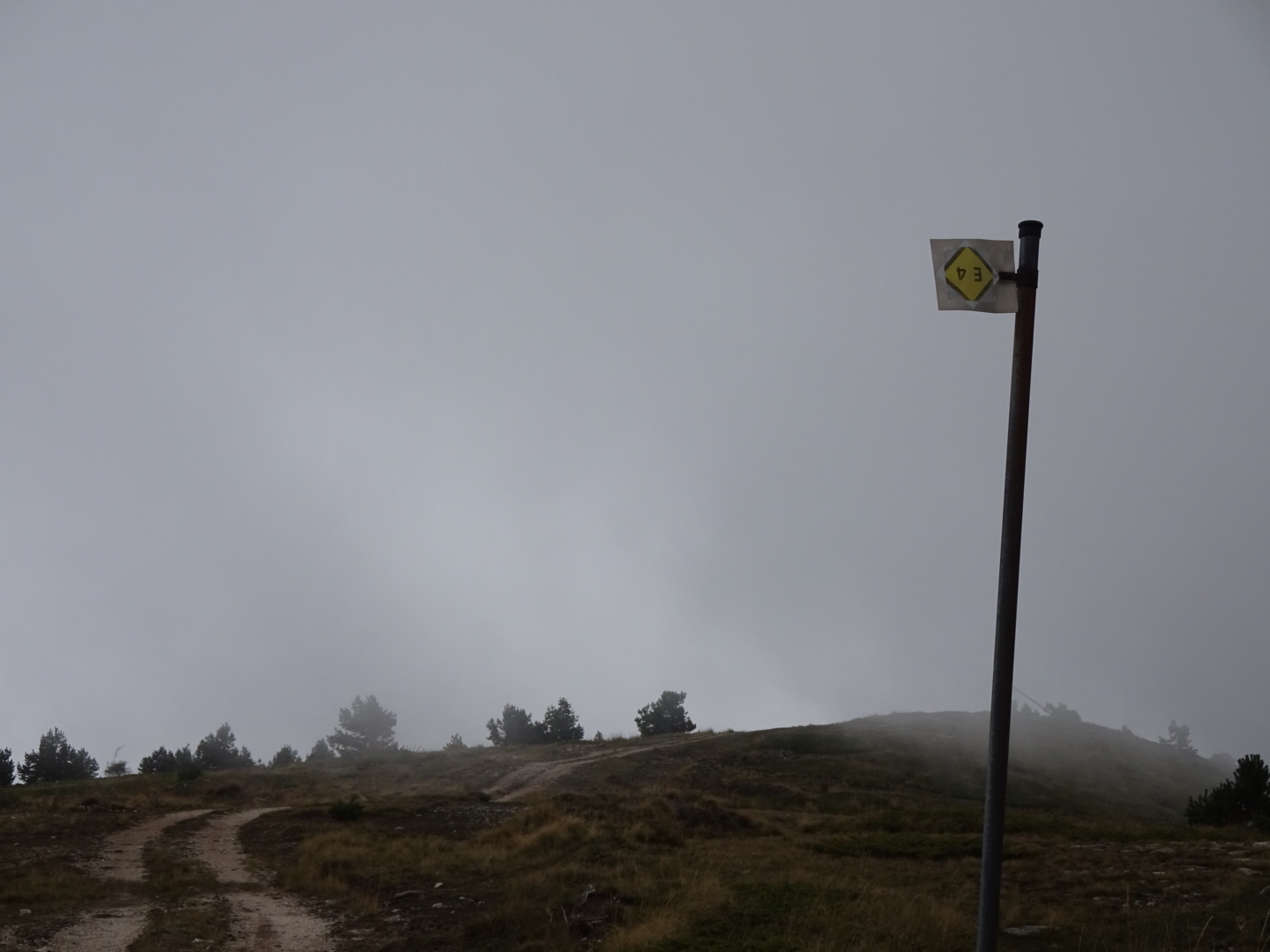
Mount Olympus and Meteora are world class sites attracting large volumes of tourists, however the section of the E4 Long Distance European trail between them appears to attract very few visits.
The grandeur of Mount Olympus with its rocky summits means fit people from many countries make the long climb (some 2600 metres from the favoured starting point of Litochoro although many seem to get transport up to Priona reducing the climb to a still substantial 1600 metres). It is an exhilarating and satisfying experience to reach the top, especially of the more difficult peak of Mytikas, and see a large piece of Greece spread out around you. You will have plenty of company on the summits yet coming down the west side of Mount Olympus to Kokkinopelos you could be the only visitor in the village.
Meteora, with its ancient monasteries built on distinctive pillars of rock to escape the distractions of the world are now overwhelmed by coach parties of tourists (or at least those parts near a car park). Most are rather less fit than those who climb Olympus but no less ready to photograph themselves with a stunning background.
In between the two sites a visitor will attract curiosity due to their rarity, although viewing the moon rising over Mount Olympus from the picturesque village of Livadi while enjoying an evening beer is a much richer experience than sitting among the coach parties in Litochoro or Kalampaka.
Despite the difficulties in knowing exactly where the E4 goes, especially after Descati, the walk from Olympus to Meteora was rather more interesting than I anticipated. While I expected farmland I had not realised quite how many hills, woodlands and mountains the route covered. Nor was I expecting villages to be halfway up the mountain side. The downside of no tourists was a lack of accommodation between Livadi and Meteora although with more effort some might be found, fortunately there were more places suitable for wild camping than I expected.
One of the pleasures of long distance walking is visiting places where you would not otherwise plan to go and your trip being enriched by what you find. For this reason missing out the bit between the two famous sites would be a loss to the experience of walking the E4.

The route I took can be downloaded as a gpx file for your GPS from Wikiloc.com or can be accessed with your smartphone using ViewRanger, shortcode johnpon0039. I did not include the route over Mount Olympus from Litochoro to Kokkinopelos, as this can readily be found on various maps and downloads.

Since completing this section my attention was kindly drawn to a German site with a GPS track of the same section of the E4. In places, most significantly between Livadero and Kalampaka, it takes alternative routes to mine, although not necessarily closer to the intended path of the E4 (whatever that is!). I have since bought the Anavasi map of Meteora, which shows that at least I arrived in the area on the "correct" route of the E4.

Sun rise over Mount Olympus viewed from Livadi

Friday, September 28, 2018

Kalampaka to home: Day 29 and 30

A return back to my home via Thessaloniki and EasyJet.
Finishing a walk is both happy and sad; happy as I will soon be home with my wife, sad as I will not be seeing new horizons for a while.
Before catching my bus I wandered up to the old part of Kalampaka at the top of the hill. I listened to the end of a service at one of the churches, impressed that the Orthodox church sticks to its rituals, with bowing and crossing and doing priestly things behind the rood screen, rather than trying to change to be "relevant" in modern times. From what I understood from the only person in the congregation it was some kind of memorial for his dead mother but he seemed OK with my presence. To reach Thessaloniki from Kalampaka you change buses at Trikala. I panicked a little as we drove through and out the other side of Trikala (the lady in the seat beside me with nails painted orange crossing herself each time we passed a church) and I had yet to get off the bus. However the large bus station at Trikala is out of town. The bus station in Thessaloniki is likewise a long way from the centre and there were no signs or information on what to do next. There were plenty of signs for Larissa, Serbia and other distant places but nothing immediate on how to get into the centre of Thessaloniki with its hotels and waterfront. I persevered and found the local buses and their little ticket office outside, paid my 1 Euro for a ticket and caught the number 12 bus. I got off somewhere near the centre and booked a room at the Hotel El Greco where the helpful English speaking staff booked me a fixed fare taxi for the airport tomorrow.
I wandered along the sea front, with the white tower and its buskers, and the market with its meat and herb shops. After watching the sun set behind the shipyard cranes, industrial but atmospheric, I adjourned to the Ladadika area and enjoyed a good and imaginative meal (the bream was prepared with spinach and capers) at one of its many restaurants watching people go by.

Next day it was taxi, a small but busy airport, a full aeroplane, standing room only on the train from Manchester airport (at least for half the journey) and finally home, plenty of time to read my kindle about the siege of Krishnapur. The tedium was rewarded by the welcome from my wife.

I should be continuing the next section of my walk on the E4 sometime in April 2019, tackling the Pindos mountains. The mountains had a light dusting of snow as I left Kalampaka.

View from Thessaloniki seafront as the sun went down

Wednesday, September 26, 2018

Descati to Kalampaka on E4: Day 28

My last walking day of this trip when after some 36 kilometres (and over 1000 metres total ascent) I reached the town of Kalampaka, walking through wooded valleys and by large rock outcrops finishing among the monasteries of Meteora.
I was on the road by 7:00 am when it was still dark. As the road reached its highest point the orange and white lights of distant villages flickered like gems below me. In the overcast morning sky my route took me several kilometres along a tarmac road as it cautiously descended down a wooded valley. Towards the end of this section a change in the landscape was evident as large conglomeratic sandstone outcrops began appearing, layers rich in well rounded pebbles alternating with sandier levels. I turned off the road onto a dirt track the led up through a valley with large rock outcrops on each side. In the side of one, built into a cave was a small chapel or hermitage, a sign said "Palaiopanagia". Steps were cut into the rock so that you could reach it, with iron handrails to prevent you falling off. Unfortunately the chapel itself was locked although some paintings could be seen. Farther up the valley the track reached the village of Vlachaba, built on a steep slope. There being no sign of a cafe I walked onto the crest of the ridge at the top of Vlachaba.
From then on it was down a valley through the woods towards Meteora, although missing a turn and blocked by a gate I had to climb back up, somewhat peeved, at one point. At another I had to throw stones to persuade a pack of manically barking dogs of assorted varieties not to come too close, the cows I suppose they were guarding were less concerned.
Finally I was approaching the famous monasteries of Meteora, built on, or into, great pillars of rock. I diverted off the main track to walk among them. The first I saw, the Holy Monastery of Ipapantis, was embedded in the side of the cliff. Visiting time finished at 14:00, about the time I reached it so I walked up a narrow path towards the Monastery of Grand Meteoran. As I rounded the hill a line of cars and coaches greeted me. It is always a shock after some days of walking in solitude to be suddenly among a crowd of people talking in many languages and taking numerous photos of themselves. I climbed up the steps of the monastery as people pushed back down towards me, oblivious to my rucksack and the extra room it needed. At the church at the top the room before the nave had lots of paintings of saints being killed in various ways (beheaded, boiled, crucified etc.). I entered the nave respectfully, conscious that with God's help, or the result of my careful preparation, I had finished my trip safely, blessed by good weather, and that I had a beautiful wife waiting at home for my return. However it was difficult to contemplate such thoughts with all my fellow tourists pushing past. Sometimes I feel invisible to people.
I picked a footpath below the monastery to head down to the town of Kastraki, its starting point easily missed due to lack of use. I immediately lost all the tourists who tend to travel by car or coach (if only because of the hefty climbs involved in reaching these monasteries). The footpath was crudely paved with small boulders and led me down to a road. Beyond that the path was somewhat overgrown but I reached Kastraki and the helpful lady in the Tourist Information office reserved a room for me at the Hotel Rex in nearby Kalampaka and booked a seat for me on the bus to Thessaloniki tomorrow.
Hotel Rex was 20 minutes down the road and the tavernas of Kalampaka awaited me for my diner.

A file of my route suitable for your GPS from Wikiloc.com, or can be viewed on your smartphone with ViewRanger, shortcode johnpon0039.

A valley enroute to Kalampaka

The Palaiopanagia?

Holy Monastery of Ipapantis

Tuesday, September 25, 2018

Amarvis mountains to Descati and beyond on the E4: Day 27

An enjoyable walk in the hills, only disturbed by barking dogs. At 48 kilometres  (and a 1280 metre total ascent) a bit on the long side, it gives me a chance of reaching Meteora tomorrow.
Overnight a cold front came in with a stiff breeze, marking the start of cooler weather. My tent (a Terra Nova Laser Competition) was designed to be lightweight rather than able to handle high winds. The main pole was being bent back and fore, the flysheet was flapping wildly against the inner tent as the wind hit the tent broadside. I feared the pegs coming loose, the pole breaking or a small tear at the apex of the tent, created on my last trip, ripping open. Fortunately none of it happened I just had to be careful as I decamped at 6:00 am that the tent did not blow away.
Setting off down the track through the woods in the light of the settling moon, the eyes of some small wild animal reflected the light of my head torch for a few moments before it disappeared. I disturbed someone sitting in his van, a hunter I assume as he was in a camouflage jacket and did not reply to my cheery "kalimera", just flashed his headlights. Does it attract animals? As the village of Livadero came into view the sun was rising in the east, the moon was large as it sank into distant haze ahead of me, conjuring up poetic thoughts.
At Livadero I stopped for a breakfast coffee. Not seeing many British tourists in town, or indeed any one with a rucksack, I was of great interest to the customers and the lady serving. They were curious as to what I was doing. One of the men paid for my coffee and the lady serving gave me some extra biscuits. They tried to insist on driving me to Deskati but I had to insist on walking. Very kind people who must have considered me strange indeed. At the earlier village of Livadi they had heard of the E4 (or epsilon tesera) and were familiar with the idea of walking it, but not here. At the entrance to Livadero a yellow sign said "E4 Descati 5hr 30", the timing was about right but as it was pointed in the opposite direction to Descati, I ignored it. Following my planned route out of town I found an E4 waymark indicating I was going the right direction, and on the dirt tracks I followed to Descati there were enough E4 waymarks to show I had picked the correct route.
The track weaved its way through the hilly landscape, by small farms, sometimes uphill, sometimes downhill. On less steep ground the hay had been gathered into barns and flocks of sheep were eating up anything left in the fields monitored by their shepherds. Beyond the fields there was rougher grassland dotted with small holm oak trees and some larger oak trees of the type common in Britain. Occasional fields of cut maize or a rare small vineyard were the only other crops in evidence. On steeper slopes and higher up the valley sides the oaks formed forests of small trees.
As I neared Descati I climbed up to the ridge of the Kamvounia mountains. The small trees were now the fluffy, dwarf evergreens common in suburban gardens. Views each side of the ridge were opening out, although Descati  remained hidden until I was nearly there. Although the town's website boasted two hotels, I was unable to contact either, nor did I see much sign of the one that was meant to be by the town's centre. So I had a good lunch (meatballs with yoghurt and tomato dips) and set off towards Meteora and the town of Kalampaka. The waiter was concerned that it was cold, and indeed it was cold compared with previous days, overcast with dark clouds since this morning but no rain as yet. He felt I should catch the bus.
As I recall, the Greek mountain society also suggested a bus between Descati and Kastraki, and there was no sign of the E4 on the 1:230000 Anavasi map between the two towns. I had assumed no route had been created between these two towns and planned a fairly direct one for myself. Consequently I was surprised to see E4 waymarks on the edge of town pointing east and a sign implying in a vague way an E4 route well to the east of the one I had chosen. It was too late to re-plan my route and since I knew I could not rely on the waymarks, I stuck to my planned itinerary, somewhat annoyed. Feeling rather full after lunch and my belly complaining I walked quickly south to the next range of hills where I am camped among oak trees listening to the crickets.

A GPS file of my route can be found on wikiloc.com, or can be viewed on your smartphone from ViewRanger, shortcode johnpon0039.


Moon rise in the morning


Typical countryside after Livadero, the track on the photo is the one I was following

Monday, September 24, 2018

Livadi to Amarvis mountains on E4: Day 26

A navigational challenge today, seeking clues as to where the E4 goes as I walked across farmland and grassland, and through groves of holm oak, covering 31.5 kilometres with an 1184 metre total ascent.
After some shopping and a coffee in Livadi I started today's walk. I had planned a few routes heading in an westerly direction out of Livadi, as indicated on the Anavasi 1:230,000 Thessaly map. Admittedly too small a scale but the only map showing the E4 route I was aware of. However, the E4 signs in the village clearly showed that the European trail was leaving along the main road in a southerly direction. Consequently I revised my planned route to head south out of town. After seeing a number of waymarks my revised route caused me to turn off the main road onto a dirt track. At this point I lost the waymarks. Maybe the E4 left the road at a later point or maybe they just ran out of signs. I knew the E4 signing could not be relied upon to show the way, so as I could see no other viable route I stuck to my (revised) plan.
The dirt track I was following joined a two lane tarmac road, presumably recent as my maps showed an unmetalled track. Dirt tracks and tarmac roads alternated for the rest of the day. Around me was a mixture of farmland (newly ploughed ready for seeding or fields of maize waiting to be cut) and rough grassland dotted with small trees and bushes which formed small woods on steeper slopes. The grassland was a dusty yellow. Some bird of prey circled lazily overhead while swallows(?) swooped.
After crossing a few valleys it was a steep pull up to the village of Saradaporo where I indulged in a Coke, a Fanta Lemon, an ice cream and a packaged apple strudel with very little apple in it. I had hoped for a more balanced lunch but only a cafe (and two small shops) were open.
I spotted some E4 signs in the village which seemed to confirm that I had chosen the next bit of the route correctly. This took me passed a white church with carefully tended roses in its walled compound, then it was down to the bottom of a valley where an older church stood, part of the Holy Monastery of the Assumption of the Virgin Mary, which was last in operation in 1919. Sadly people had carved graffiti into the obviously old paintings on the front of the church, although all was untouched inside. As usual the paintings on rood screen (more correctly called an "Iconostasis" as this was an Orthodox church) had a lot of gold leaf around the solemn faces of Jesus and the Virgin Mary.
Next challenge was climbing out the other side of the valley as there was no clear path either through the prickly bushes or up loose rock and earth. Fortunately the goats seem to have made a way through the bushes which I followed continuing onto a clearer track and later a road. I was walking through woodland made of low trees. The main type had what looked like miniature holly leaves, but as it also bore occasional acorns I took it to be a type of holm oak. There were also the more common oak trees mixed in. A steep upward climb took me to the small village of Tsapournia. Sadly the cafe was closed so I continued climbing up to the highest point on the E4 trail across the Amarvis mountains. A grassy hill top looked a good place to pitch my tent, but large numbers of flies are forcing me to stay inside it.

A GPS file of my route can be found on Wikiloc.com, or you can use ViewRanger to view it on your smartphone, shortcode johnon0039.


Looking back towards Livadi as I walked towards Saradaporo

Entrance to the church at the Holy Monastery of the Assumption of the Virgin Mary, people have scratched their initials on these paintings

Sunday, September 23, 2018

Kokkinopelos to Livadi on E4: Day 25

The first part of today's walk was across a pine covered mountain, the second, up a tarmac road to the village of Livadi. A more gentle day with 19 kilometres covered and a total ascent of 640 metres.
As I walked through the village this morning, being a Sunday, Mass was being broadcast over a loudspeaker from the stone built church, sometimes mingling with music from radios. The taverna was just opening for business. Going up the dirt road out of the village I could see hunters with bright orange hats and excited dogs on the hill opposite. Not wanting to be shot accidentally I turned my "Buff" into a red skullcap to increase my visibility. More hunters later passed in their pick ups. 
From Kokkinopelos to Meteora there were no GPS tracks available for download so I had created one from the maps I had available and Google Earth. E4 waymarks and signs were intermittent, bunched together and sometimes full of holes from someone's target practice, but there were enough of them to confirm I was on the right route. A kilometre or so outside the village I turned onto a vehicle track into the pine woods. The track curved up and around with occasional breaks in the trees where I could see across to places I would be walking to tomorrow. After climbing for some time the route bypassed the summit and then gradually descended via a series of switchbacks.
On reaching a major road I crossed to the side road opposite which took me up to the village of Livadi. I managed to missed out one bit of road on a track but most of the time I was on tarmac. The road was quiet and after the road had climbed to around 1200 metres it contoured around the hillside and I could see long distances across the surrounding plains with their fields, farms and forests. Livadi came into view, its red roofs spread over the side of the hillside like a village in Southern Spain. I found the narrow streets in the centre full of people spilling out of the local tavernas in a charming scene.
I checked into the Hotel Mytikas, named after the highest peak on Mount Olympus, one of those I climbed yesterday and which I can see from my balcony along with much else. I was in time for a late lunch at the Asteria restaurant next door. The lamb chops were full of flavour and the waiter helped me with some background. I was in a Vlach village, where they speak a language related to Latin (as well as Greek). There was a conference on the culture taking place in the village, hence the crowds. He pointed out the statue of a Vlach who helped drive out the Ottomans in the last century. I asked about the yellow flags with black eagles on, which I had often seen with the Greek flag. He explained it was a Byzantine flag and referred to the Orthodox faith, and that there was a sort of spiritual war being declared to preserve Christian Orthodox values.
In the evening I had a beer on the hotel terrace and watched the full moon rise over Mount Olympus, a beautiful sight.

A GPS file of my route can be found on Wikiloc.com, or use ViewRanger to view it on your smartphone, shortcode johnpon0039.

The attractive village of Livadi

Moon rise over Mount Olympus as viewed from the terrace of the Hotel Mytikas


Saturday, September 22, 2018

Mount Olympus on E4: Day 24

My achievement today was reaching the top of Mytikas, the highest peak on Mount Olympus, then a long descent to the village of Kokkinopelos. 22 kilometres walked with a 1200 metre total ascent, and a bigger descent.
Breakfast was available from 6:00 am, which was when I joined the end of the queue. I was not the only one planning an early start. Some of the men looked pretty tough, with haircuts to match and blue, mirror sunglasses. It made me wonder if I was up to the task of climbing Mytikas, which requires some skill on rocks and a head for heights. In fact I soon overtook the tougher looking guys, it was a thin, wiry couple that overtook me later on, as they moved, effortlessly from rock to rock like gazelles.
Mount Olympus looked particularly beautiful as the sky brightened and the rising sun coloured the rocky peaks ahead of me, pink against a blue sky with sharp black shadows marking ravines. I climbed out the trees admiring the grandeur of the place, onto a more slippery gravelly track.
Reaching the first peak of Skala which some dogs from the refuge had reached ahead of me, I had to decide whether to tackle the much more difficult climb up to Mytikas, the highest peak at 2918 metres, home of the God Zeus. The God of thunder among other things he was being kind today, the weather was perfect with no wind and empty blue skies. The rocks were dry and seemed to have plenty of hand and footholds. I had been on a scrambling course at Plas-y-Brenin before the trip and had spent another week in Snowdonia practicing, as the climb up Mytikas was classed as a Grade 1 scramble I should be up to the task. Everything suggested I could give it a go, so following the red spots helpfully painted on the rocks I climbed down from the top of Skala (part of the route to Mytikas). Going down is always more difficult than going up as I carefully looked for each foot and hand hold before making a move. I reached the saddle between Skala and Mytikas and started to climb the steps of rock. The difficult bit is going down and around a pinnacle that stands to the west of the Mytikas summit. There is a bit of wire attached to the rock to help. The final bit going down is awkward (unless you are brave enough to stand up), but then it's a simple climb to the small summit of Mytikas where the two gazelles who passed me earlier, were now enjoying the view, one standing on the pillar on the small summit oblivious to any fear of heights. At 2918 metres it is the highest peak on my trip so far, narrowly beating Mount Vihren in Bulgaria by a mere 4 metres.
Heading back was not so bad although there were now an increasing number of people on the mountain. As I climbed back up to the Skala summit there was a large group on a rope to get around, a guide at each end, and others were preparing to follow them. I was glad I started early to avoid all these people. How they would all fit on Mytikas summit I don't know.
I sat on Skala and enjoyed a few biscuits working out what all the mountains I could see were. To the north there were the Pieria and Vermio mountains I had crossed as well as the large windfarm. Looking west I tried to see the next stages of my trip. In the far distance a range of mountains marked the horizon, I took these to be the Pindos mountains that I will walk along next year. Lots of people on the now crowded summit of Skala were taking pictures and I worried that someone would step back too far in framing the perfect selfie with Mytikas in the background and fall off the near vertical north-west face of the mountain.
Having achieved two summits, and rested after spending a day in Litochoro, I decided to climb Skolio as well. A less popular summit it gives great views back to Mytikas and the big drop on its north-west side (which I had carefully avoided looking at when I was climbing it).
It was time to head towards Kokkinopelos. The trail down to Refuge C took me past three Balkan Chamois with their curious bent back horns (I knew what they were as I had seen pictures of them in the National Park Visitor Centre in Litochoro). Having been very careful on Mytikas I now slipped and landed on my bottom on the easy but gravelly path down! Fortunately nothing damaged but my pride.
I passed a few walkers coming up, but from the number of cars parked at Refuge C it seems they were taking an easy route to the summit as Refuge C is a 2450 metres, whereas most people climb from Priona at 1100 metres or from Litochoro at around 300 metres.
After the unmanned Refuge C, I followed the vehicle track as it lost and gained height until the E4 moved away from it at a cattle pen. From this point the E4 follows a footpath down a narrow wooded valley, and looses height rapidly. Signs indicated that the path was also used for the Olympus marathon, although I would not want to run on the rocky surface. In places the path looked about to dissappear but after some ruins it followed a good mule track that climbed out of the valley and around the hillside to Kokkinopelos, giving some great views across the farmland and mountains to the west.
I am now at the Hotel Dias. It has seen better days and I am the only person who appears to be staying here, but is half the price of places in Litochoro and as the owner has just cooked me diner, I am happy. All the tourist activity appears to be focused on the east side of Mount Olympus which means Kokkinopelos is quiet.

Path up to Skala summit from Refuge A in the morning light

A group coming down from Skala summit towards Mytikas clipped to a rope

Balkan chamois

Looking back at Skolio summit from the south-west

Path to Kokkinopelos, empty of people after the crowds on the top of Mount Olympus

Friday, September 21, 2018

Litochoro to Refuge A on E4: Day 23

A long, long climb up good paths to Refuge A, stopping at Saint Dionysios' cave, his ruined monastery and the taverna in Priona. 22.8 kilometres walked today and an enormous 2235 metres of total ascent.
Leaving Litochoro I followed the E4 path into the Enipea gorge. The path followed the side of valley, built into the steep slopes among mixed woodland. Unlike the rest of the E4 I had encountered in Greece the footpath was good and clearly marked, my GPS was rarely needed. Crude steps had been created in places and there were even some handrails made of tree branches. Although there were some rocky bits to clamber over the path was not difficult apart from the unrelenting upward gradient. Due to the trees the water running in the base of the valley was rarely visible, but when it was you could see cataracts of clear water running over the rocks. After leaving the environs of Litochoro I had the gorge to myself, although later, groups of people started coming down the path towards me, especially after reaching the cave where Saint Dionysios lived as a hermit. A tiny blue and white chapel stood on the spot. A little beyond it were the ruins of the monastery he founded, destroyed during the second world war but now partly reconstructed. There was not much at Priona: a car park, toilets and a taverna where I enjoyed a goat hotpot and Greek salad.
On the ascent from Priona to Refuge A there were a lot more people with backpacks, mixed in the early stages with day trippers who had parked at Priona and were enjoying a short walk. There were some big groups of numerous nationalities coming down the mountain. Prior to reaching Litochoro I had seen no walkers on the E4 or anyone else with a rucksack, but now the path was overrun with them! Above Priona the trees were all pines, the path was steep with many switchbacks and I gained height steadily.
Refuge A itself (full name Refuge Spilios Agapitos, but invariably called Refuge A) was well organised with numerous rules (no boots inside, pack out your rubbish etc.) and an ability to deliver food orders very quickly. This was fortunate as the place was full. There were quite a few from Israel, apparently it is a holiday period there and I suppose Greece is not so far way. The refuge sold beer, brought up on a train of horses I passed going down on the footpath. I enjoyed a can looking at the clouds obscuring the valley until it became too cold and I retreated to my dormitory and my kindle.
Before getting into bed (the first in my dormitory) I went again to see the view now it was dark. The clouds had cleared and the lights of Litochoro were flickering at the end of the Enipea valley. Beyond them was the blackness of the sea and on the far horizon a line of very distant lights from towns a long, long way away.

Ruins of old Monastery of St Dionysios

The path coming up from Priona as viewed from Refuge A

Looking down the Enipea valley

Thursday, September 20, 2018

Thoughts on E4 from Florina to Litochoro

This section of the E4 in Greece crosses three mountain ranges: the Verno, Vermio and Pieria mountains, and two flatter areas; the first south of Lake Vegoritis and the second being the coastal plain around Dion. The mountains are clothed with woodland on their lower slopes and grassland spread with creeping juniper higher up. I encountered many herds of cows and flocks of sheep looked after by men living in shacks that dot the hillside. I assume this is transhumance farming with the men and animals moving to lower pastures in the winter. The  lowlands are agricultural with orchards of peach, apple and kiwi, vineyards, hay meadows, fields of maize etc..
Despite the mountains I met no hikers enjoying the scenery and people seemed to think my walk a bit odd. Intermittent waymarks reassured me I was on an international hiking trail but little else. Since the route of the E4 was fixed in this area many of the footpaths have often become overgrown whereas the vehicle tracks are maintained through regular use by herdsmen and hunters. Some rerouting is needed, especially at the Sfikia dam, which I would recommend avoiding due to the difficulty reaching it and because access is discouraged.
There are some interesting churches and monasteries on the route, as well as archaeological remains at Dion. Nimfeo is an attractive stone built village in the mountains, and the bear sanctuary worth a visit. Look out for tortoises and the footprints of wild bears on the tracks. Some wild camping is needed to cross the various mountain ranges although there is probably more accommodation than I managed to find. September was a pleasant time to walk the route although it can get cold at night. Dogs were a nuisance, barking at your approach, although not as aggressive as some I have come across.
GPS files of my route can be found on wikiloc.com (clink on links here and here and here), or on ViewRanger, shortcodes johnpon0036, johnpon0037 and johnpon0038.

Rest day at Litochoro: Day 22

A rest day seemed prudent before climbing up Mount Olympus and the tourist town of Litochoro and the comfortable Hotel Xenios Dias seemed an excellent place to take it.
One of the town's attractions was the Olympus National Park Information Centre, a little way out of town. It had a display of the flora, fauna, history and mythology of Mount Olympus with lots of colourful photos and with English translations throughout. As you went higher in the building information on higher up the mountain was displayed.
An extremely, helpful lady in the Tourist Information wooden hut in town put a lot of effort into finding accommodation for me on the stretch of E4 after Mount Olympus, reserving me rooms in hotels I was unable to find on the Internet. In addition to local knowledge the trick is to search Google in Greek. While Google does translate search words from English to Greek it is not perfect, possibly because Greek letters are often transliterated in different ways so the same place name can be expressed in a number of ways in Latin letters.
Having filled up my belly, stocked up on batteries and snacks, and rested my ankle I feel ready for tomorrow's challenge.

Evening in Litochoro, lots of people were sitting in bars watching the football match on big TV screens.

Wednesday, September 19, 2018

Dion to Litochoro on E4: Day 21

A day walking through farmland and scrub to the tourist mecca of Litochoro - somewhat frustrated by fences. A short day at 13.8 kilometres with 480 metres of climbing.
The result of washing off the dirt of five days wild camping yesterday, was a film of dried-on, dirty scum on the bottom of the shower unit. After spending time trying to clean it off I started off down the road, stopping to look at the fields of kiwi fruit vines interspersed with more traditional vineyards. Although a busy road there was pavement or a cycle track most of the way to my turn off up a quiet dirt track. I had download the two "official" GPS tracks that covered today's journey. They led me along a number of vehicle tracks through farmland and scrub. Evidently the routes were somewhat dated, as fences had been erected in a number of places that forced me to take a somewhat different route. At one fenced off area they definitely did not want you to enter... After an initial stretch through farmland it was uphill through a scrub of low trees and bushes following I thought, tracks made by hunters. Indeed a convoy of pick ups passed me. On one was a very large, dead wild boar. They must have been pleased with themselves for killing it.
The tracks joined a tarmac road shortly before the monastery of Agioy Dionysioy. Three coaches and a dozen cars were parked at the monastery, one luxury coach had "Tramp Travel" written on the side which made me smile. A pretty place with the upper storey of the buildings jutting out over the ground floor. In addition to the lavishly gilded icons and chandelier in the church, there was a museum with ancient manuscripts and some relics. These were bits of bones from saints set in silver casings. Something I find a bit gruesome rather than sacred. The monastery was actually built after the second world war, during which time the old monastery in the Enipeas gorge was deliberately destroyed. I will see the ruins on my way up Mount Olympus.
From the monastery I tried to follow the GPS route to Litochoro but hit padlocked gates on my first attempt and the footpath disappeared on my second, so it was down the main road with motor homes passing me. I am now at the Xenios Dias hotel enjoying an evening glass of Metaxa Greek brandy (a rather large glass by UK standards). In the centre of town, the hotel seems very pleasant and looks out onto a square of cafes.

A GPS file of my route can be found on wikiloc.com, or you can download it on your smartphone from ViewRanger, shortcode johnpon0038.

Monastery of Agioy Dionysioy

Tuesday, September 18, 2018

Pieria mountains to Dion on E4: Day 20

Downhill from the mountains into the foothills and then across the coastal plain to Dion, where I visited the ancient remains.
As I had a long walk today (36 kilometres) I started while it was still dark, causing a pick up to stop (the first I had seen for over 24 hours) and ask what I was doing. People demanding something that sounds like "qui passe?" is quite a common challenge. A walker is not a common sight in these parts. I usually then say "Anglica", which is meant to mean English (and by implication I don't understand you) but people seem to confuse it with Albanian!
In walking to Dion I had been trying to follow the E4 route as marked on the Anavasi Macedonian map as there was no GPS track I could download from the Internet for this section. It is on a small scale for walking so I had devised a route that followed roads and tracks I could see on Google Earth and/or the Balkans Navitracks map on my GPS, and was broadly consistent with the path on the Anavasi map. This involved a mixture of quiet tarmaced roads, gravel tracks and the occasional rough path. I was on the correct E4 route at least occasionally as I spotted some waymarks.
I walked through the village of Ano Milia just as the sun was rising and I could see the top of Mount Olympus which I would soon be climbing before it was later lost in cloud. By the time I reached the larger village of Kato Milia its cafés and shops were open. After a coffee from the first café, a bar of chocolate from the shop next door and a flaky pastry affair from a bakery shop I was feeling ready for my first challenge.
I was concerned that the route went over a river and that I could see no sign of a bridge on Google Earth. If I could not get across, it would mean a detour of several kilometres. However, E4 waymarks leading out of Kato Milia provided reassurance, leading me to the river where there was a ford, shallow enough for me to splash across without wetting my socks. Bypassing the village of Rachi, a winding road took me to Lofus, the next village. I walked passed the first few cafés but the last one also sold cakes. In the interests of research into Greek patisserie I had a Coke and a huge flaky pastry cone filled with cream and topped with nuts. I rationalised it to myself by thinking I needed the energy for my walking.
I continued by olive groves, fields of vines, drying tobacco leaves and fields of hay. After early up and downhill sections the ground now became very flat. A busy main road took me through Karitsa and onto the village of Dion. I hoped for a hotel and was disappointed when the first one was long closed, its front yard overgrown. But a sign pointed to a second one, the "Safetis stories", opposite the museum. An elderly lady in black with a zimmer was on reception, after struggling to reach it she pressed a bell and another lady thankfully gave me a room, a few rooms in fact, it was an apartment. I was very thankful as I was very dirty, smelly and unshaven from five nights of wild camping. I gave her the money quickly before she changed her mind and then headed for the shower. When I had finished the soapy foam that had not drained away was a dirty brown.
Dion was an important town from 5th century BC to 4th AD. The museum had some impressive exhibits (what was Leda doing with the swan, or vice versa?), including an early organ (the kind with organ pipes) from the first century BC. The actual ruins in the archaeological park were less impressive, there are many far better around the Mediterranean. They were also spread out and after a long day walking perhaps that made me less enthusiastic.

A GPS track of my route can be found on wikiloc.com, or you can download it on your smartphone from ViewRanger, shortcode johnpon0038.

My first confident sighting of Mount Olympus before it clouded over. It seemed most clear of clouds early in the morning.

I took these to be tobacco leaves drying

Ancient remains at Dion

Monday, September 17, 2018

Pieria mountains on the E4: Day 19

A somewhat cool and cloudy day walking 27.8 kilometres among the Pieria mountains through woodland and across open countryside on vehicle tracks, as the footpaths indicated by my GPS proved elusive. 870 metres of total ascent.
The day started on a forest track through beech trees and conifers, passing a herd of cows. As the trees thinned out I could see mountains and plains spread out in the haze. The extensive Polifitos reservoir was prominent in the foreground and part of the windfarm I crossed two days ago was on a ridge in the middle distance. On reaching the Bara "shelter" I found a two storey building locked up but bedding, food and cooking equipment showed that two, somewhat untidy people were using the glassed-in veranda area as a temporary home. Shepherds or cowherds I assumed, looking after their animals on their high, summer pasture. Further on, some shaded picnic tables looked as if they were mainly frequented by cows judging from the amount of manure.
The GPS route I downloaded indicated I should turn off onto a footpath a little way beyond the Bara shelter. Although the footpath was also marked on my Balkans Navitracks GPS map, after a few hundred metres the path (or what may have just been cow tracks) became difficult to find, long overgrown by creeping juniper and blueberry bushes I expect. Having been thoroughly abraded just above the top of my boots by juniper needles and with mist from low clouds starting to hide any sign of a path I headed for a nearby vehicle track that which would intersect my GPS route in a few kilometres based on my Navitracks map. I was surprised to then find E4 waymarks on the vehicle track, contradicting the downloaded GPS route, albeit fitted to metal posts upside down! To the right of the track there were some potentially scenic rocks as the ground dropped away but any more extensive views were obscured by low cloud.
I continued for the rest of the day following vehicle tracks, ignoring where the "official" GPS route suggested I should take off into the undergrowth and trees, down some steep slope, on some path that was invisible to my eyes. This added a few kilometres but made for a more pleasant ramble.
For the latter part of the day I was dropping down into trees and I am now camped in a steep sided valley of beech trees on a flattish patch of ground, well below the level of the vehicle track, a few kilometres outside the village of Ano Milia.

A GPS file of my route can be found on wikiloc.com, or you can download it on your smartphone from ViewRanger, shortcode johnpon0038.

View back to Polifitos reservoir

Inverted E4 sign on the vehicle track I decided to follow

Sunday, September 16, 2018

Kastania to Pieria mountains on E4: Day 18

A hazardous descent to the Sfikia dam was the first big event of the day, the second was when I was briefly detained by the dam's security guard.
The Vermio and Pieria mountains are separated by a deep valley in which four dam's have been built to generate hydroelectricity. In consequence I started the day at 1000 metres, dropped to 130 metres and am now camping at 1520 metres. In total I climbed 1720 metres over the 37.7 kilometres I walked today.
Reddish bands stretched across the cloudless horizon as I emerged clumsily from my tent, a prequel to the red balloon of a sun clearing distant hills. An easy walk through scrub then took me to the village of Mikri Santa where there was little to detain me. The subsequent track was initially good although I was concerned that I had not crossed the motorway that runs down the valley, until I realised it was in a tunnel beneath me. I soon joined a section of the "official" GPS route of the E4 I had downloaded from Traildino.com, which was to take me down to the Sfikia dam. I had assumed this would mean a reasonable route although possibly overgrown as I had trouble spotting it on Google Earth, which also showed no obvious way in which it joined the road over the dam itself.
Possibly created to install some electricity pylons the track was overgrown becoming more so as it progressed, zig zagging back and forth down the steep side of the valley. At one point I met a hunter (in camouflage with his rifle in his hands). He was no doubt displeased with the noise I was making slithering over loose rocks. The most difficult bit was the last section, straight down a narrow chute of loose scree, the rocks slipping beneath my boots creating minor avalanches. I can see why this route was chosen, the surrounding, very steep slopes were covered with impenetrable vegetation, stunted trees and bushes with thorns, or else there were vertical rock faces.
On approaching the reservoir there was a terrace which I followed towards the dam through an area of rusting oil drums. I stuck to the GPS route as it followed the outside of a tall, wire fence up to where the transmission lines rose out of the site. This area was also securely fenced off due to the high voltage lines inside. The side of the valley had been cut into to make a concrete coated, near vertical face on one side of the enclosure so I had to go around the other side, where I followed a narrow ledge between the fence and a significant drop to my left. This led me to the roadway across the dam which continued around the side of the valley to where closed, electronic metal gates, fencing and a security guard prevented me from leaving the site.
Thankfully the security guard was both professional and considerate, giving me a coffee and biscuits while he made and received various phone calls and I showed him my Anavasi map with the E4 marked. After some calls he handed me the phone so I could be questioned by someone who spoke English. I explained I was walking the E4, which was marked as crossing the dam. He seemed surprised I had managed to get down to the dam from the other side and wanted to confirm where I was going next. In the end it was agreed that I would show my passport to the security guard so that my details could be recorded in what I took to be the visitor's log. The gates were opened and I left the guard dealing with a group of leather clad motor bikers who had just arrived.
Due to the hazardous descent and because there is no provision for hikers to cross the dam I do not recommend you take this route. Instead you could go via Veria which will add 42 kilometres to the walk, maybe a day and a half.
The rest of the day was a little less stressful, beginning with a climb up the road, which wound around the hills to gain height and reach the village of Sfikia. In the village was a friendly café where I had a Coke and ice cream. They kindly filled up my water bottles as I was having trouble finding springs in the last day or so, then I was waved off by a group of those at the café as I made tracks for the village of Rizomata.
Between Sfikia and Rizomata there was another gap between two of the GPS tracks I had downloaded. Google Earth showed no sign of a track through the wooded hillside in the gap. Having gained enough scratches getting down to the dam I decided on the longer but reliable  route to Rizomata along the tarmac road with an increasing number of fields of tomatoes as I approached the village.
After a good lunch in a "fast food" restaurant, and the purchase of something I randomly pointed at in the bakery for dinner (being Sunday all the other shops were closed but the door to the bakery was open, maybe because the owner was cleaning the floor).
Then it was time for a big climb. Fortunately the tracks up through the trees, clinging to the steep slope, were easy to walk on if tiring. They led me to a ski resort, closed for the summer. Shortly after I found an abandoned track with a patch of flattish ground on which to pitch my tent for the night and to eat my pastry concoction which seemed to consist of just pastry!
P.S. I did have an apple, biscuits, nuts and dried apricots to eat as well.

A GPS file of my route from the Sfikia dam can be found on wikiloc.com, or you can download it on your smartphone with ViewRanger, shortcode johnpon0038.

On the opposite side of the valley, the track I walked down to the dam on is just visible as it takes a zig-zag path, note that the last bit down loose scree looks vertical.

Sfikia Dam

Saturday, September 15, 2018

Vermio mountains to Kastania on E4: Day 17

A large windfarm and the Panagia Soumela Monastery, were the two main sights of today. 33.8 kilometres walked with a total ascent of 860 metres.
After a circuitous walk across grassland and down a wooded valley I arrived at the village of Xirolivado.  Two gentleman were drinking coffee on a bench at the entrance of the town and I asked if there was a café nearby. By miming the turning of a key they indicated it was closed, a disappointment as I was looking forward to a morning cuppa.
I had to retrace my steps a hundred metres or so to where the next stretch of the E4 started. This was another of the gaps in the GPS tracks I had downloaded for the E4, it extended from Xirolivado to the next village of Kastania. I had created a route based on Google Earth and two tracks on Wikiloc.com (from Xerolivafo and to Kastania). There were some E4 signs nailed to telegraph poles on the start of the route I picked, which showed I was at least starting on the correct route. Around the valley there were distant sounds of excited dogs and the occasional boom of a shotgun. People out on a Saturday hunting expedition. Climbing steeply my route took me through trees to the top of the ridge. At the crest I entered a windfarm covering a large area of open hills. My route followed the brilliant white, gravel roads created by the owners of the wind turbines. I had seen the first of the turbines from near my campsite last night, then they were still but now they were turning slowly in an imperceptible breeze. The tracks I had picked went up and down across the grassland with side roads going off to individual turbines. My right ankle was giving me some pain on all the "up" sections. I stopped to look into the church of Agia Paraskeya Polymyloy; another highly decorated church, every surface elaborately painted, including the ceiling.
After many more turbines it was time to descend. The path I had picked was a rocky animal track that dropped steeply to a dirt track, below that another track led through trees, passing a few makeshift shacks to reach a tarmac road. I debated at this point whether to divert an extra half kilometre to visit the Panagia Soumela monastery. I am glad I did as in addition to a church full of frescos and icons, candles and golden finishes there was a selection of restaurants. I thought a late lunch was much deserved and it was certainly much enjoyed. The monastery replaces one in Pontus in Turkey from where the monks were forced to flee in 1923 and is associated with the Pontic Greeks who came from that area.
After walking through the adjacent village of Kastania looking in vain for a shop I continued on my walk. With my ankle giving intermittent pain I decided to stop early and after a few kilometres found a pleasant camping spot, hidden from the nearby track but with a good view of the villages and mountains the other side of the deep valley, which I would visit tomorrow.

A gpx file of my route for your GPS can be found on wikiloc.com, or you can access it on your smartphone at ViewRanger, shortcode johnpon0036.

Early morning walk through the trees

A small part of a large windfarm

Mosaic on side of Panagia Soumela church

A cow waiting at a disused petrol station, unlikely to get served

Friday, September 14, 2018

Vermio mountains on the E4: Day 16

A day in the mountains across open grassland and through woodland with a number of ascents and descents. 34.9 kilometres with a total ascent of 1195 metres.
A light frost greeted me as I left my tent to brush my teeth, looking down at the lights of the villages on the plain below in the faint dawn light. Cold as it was at first I knew that in an hour or so I would be sweating. The first part of today's walk was along a footpath (although not the one I mistakenly started out on) across grassland with a few yellow and black waymarks painted on rocks. Heading downhill through trees I approached a junction where prudence made me wait while a flock of sheep was taken out to pasture, keeping well back from the trio of large, white, barking sheepdogs that placed themselves between me and the flock. A climb followed passed some shacks and a sheep pen still full of sheep (I assume they are kept in these pens overnight). Dogs barked their warnings and the shepherd gave a cheery wave.
A track, high up on open grassland followed. At one point it went near a scattered settlement of houses with white walls and red roofs, a lone man waved a greeting from the ridge nearby. The mountains are not as empty as I had imagined before my trip. A long downhill section on a dirt track through conifers took me passed another settlement (called Ano Seli).
The only problem with descents is the climb that inevitably follows to regain the height you have just lost. This proved painful! The small path that led up through the trees was very steep. Its starting point in the valley off a larger gravel track was difficult to find, but once on it guided by the route on my GPS, there were many yellow E4 diamonds. On reaching a forest track the path should have continued on the other side but it was difficult to find, possibly some work repairing the forest track had obscured it. I followed the GPS route I had downloaded through the woods along what may have been the path but the absence of waymarks, relatively common lower down the slope was puzzling, maybe the GPS route was wrong? Fortunately there was not too much undergrowth below the trees so I only had to cope with the unremittingly steep upward gradient. Pushing through some trees having lost any path (or animal track) there might have been I reached the next forest road and again followed the GPS route across it and up the other side. Here the path was faint but visible. Some years ago crude steps and handrails had been constructed from tree branches to help you to the top. Now much dilapidated they were encouraging as I pushed aside occasional tree branches to reach the summit. Picnic tables (a cue for some lunch) and a lookout tower plus a panoramic view of the surrounding mountains greeted me at the top. Earlier the Aegean sea was maybe just visible in the distance but it was now too hazy to see that far.
A track took me down to the base of the chairlifts of the Seli ski resort, looking very dead out of season. There was the possibility of accommodation in the village of Kato Vermio below (also called Seli by the locals) but booking.com said it was sold out and I did not want a wasted climb down (and back up again) on the chance that something was available. However looking back after walking a kilometre or so the village looked nearer than I thought, maybe I should have detoured after all?
I followed the track around the empty grassy mountains until around 6:00 pm. Seeing a flat spot in a sheltered, dry valley I decided to camp. There was nobody around and everything was quiet as I pitched my tent, but inevitably, once I had finished a pick up and scooter stopped nearby. I was on a nearby summit trying to get a mobile signal to let me wife know my location (as I do every night, she has a record of my itinerary and keeps track of where I am). Once I had come down the owner of the pick up whistled to me so I felt obliged to walk over to him and explain what I was doing by pointing to the E4 on my map (a useful way of communicating with my lack of Greek). They thought it was very strange that I was camping out in the cold. After they had tried (and failed) to persuade me to go back to Seli I returned to my tent. A strung out herd of cows then went by and a group of dogs stood and barked at me. I threw a few stones (pieces of milky white quartz I noticed) which kept them at a distance and after half an hour or so in which they had play fights with each other their patience expired and they went off somewhere. Finally as darkness was falling I was left alone to enjoy the quietness I had experienced for most of the day.

A gpx file of my route for your GPS can be found on wikiloc.com, or you can access the route on your smartphone from ViewRanger, shortcode johnpon0036.

Passing a flock of sheep with their shepherd, going out to pasture in the early morning

The Vermio mountains

A small settlement beside the track with typical white walls and red roofs

Overgrown steps and handrail up to a picnic site and lookout tower

Thursday, September 13, 2018

Amindeo to Vermio mountains on E4: Day 15

A 33.4 kilometre walk across lowlands past peach and apple orchards in the morning followed by a big climb into the Vermio mountains after a free lunch. A total ascent of 1550 metres.
After breakfast I headed off along the road to the dusty village of Vegora passing vineyards, some still heavy with grapes, abandoned farmland and an old quarry. Then across flat land to the village of Maniaki passing extensive orchards and the occasional field of maize. Although the fruit had been picked, some left on the ground suggested they were orchards of peach trees. As I walked gently uphill towards Maniaki, Lake Vegoritis spread across to my left, with rocky mountains beyond.
At the village I had an iced expresso and ice cream in the bar while watching the local men play cards enthusiastically. The landscape was arid and dusty as I climbed up a dry valley out of the village. After crossing a busy road the route took me through acres of apple orchards. Apple picking was in progress with lorries and tractors coming and going on the dirt track. The harvesting was timely as ripe apples were collecting on the ground. A great deal of effort was being put into these orchards including irrigation and in places, nets were installed to keep off the birds.
Pirgi was a village in the midst of the apple orchards. Walking into the open area in front of what appeared to be a taverna (signage was often lacking in this area) looking for lunch, I was addressed by a kind Greek gentleman with grey hair who spoke English. He ordered some food for me and insisted on paying. He had his son with him who was visiting from Miami where he worked. Although they were familiar with the E4 they seemed to think it a bit odd that I wanted to walk it (although they said it was very beautiful in the mountains I was about to climb). In particular they were concerned that the path up was overgrown and that I might get attacked by unspecified animals while camping in the mountains. To avoid the overgrown section of path they described a different route.
As I left the village there was a small archaeological site on the roadside - remains of a Macedonian tomb. I had passed a sign to another archaeological site in Vegora but gave up trying to find it, so I was pleased to see this one - not that there was much to see. Reaching a small reservoir my friends at lunch had advised a left turn, but that would have taken me on a road back to the village. If I had left the village on that road however then my intended route was on the left of the reservoir, although there was also another road at the junction that they might have been referring to. There were in truth a confusing number of roads leading out of the village to various orchards so I stuck to the route I had planned on my GPS, which seemed to agree with the rare E4 waymarks and led me through the apple orchards and into woodland.
Now the GPS routes I downloaded had a one kilometre gap between the one I was following and the next one. In my planning I had created a route to fill the gap based on Google Earth. It became apparent that the gap corresponded to a more overgrown section of path, thankfully not too overgrown and I managed to push pine saplings and tree branches aside without too much trouble although the path was steep in places. Suddenly coming upon a cliff was a bit of a surprise but the route just went around it.
The path led to a higher dirt road. As I had been heavily drinking (water) as I climbed in the heat, I backtracked down the road a little to fill up my water bottle from a stream, adding a sterilising tablet "just in case". Unlike some sections of the E4 there were not any springs by the track.
Following the dirt road upward, I was taken through pine trees into open grassland. There was a herd of cows and later a flock of sheep with their shepherd in the distance, but not any threatening wild animals, at least not yet. I am now pitched on a pass at a high point on the trail. As I was warned it is pretty cold at this height (about 1900 metres) so an early night tucked up in my sleeping bag is in order.

A gpx file of my route for your GPS can be found on wikiloc.com, or you can access the route on your smartphone from ViewRanger, shortcode johnpon0036.

Apple orchards

View back across apple orchards with Lake Vegoritis in the distance

Climbing into the Vermio mountains