Monday, May 6, 2019

Delphi to Itea and Patra on the E4: Day 48

A walk down an ancient path to Itea, then by bus along to the coast to Patra, in the Peloponnese.
From Delphi there is a path signposted to Kirra, said to have been used in ancient times by people coming up from the port on the coast to pay tribute to Apollo at his temple at Delphi. Well waymarked at first with a variety of symbols these die out among the olive trees on the coastal plain. As the path dropped down from Delphi, the landscape was one of limestone rocks, abundant and colourful wild flowers and terraces, no longer cultivated. In front of me I could see the coastal plain with mountains each side, the adjoining towns of Kirra and Itea, and the wine dark sea. I passed the occasional church and skirted the village of Chrisso before reaching the plantations of olive trees. On route I disturbed a snake sunning itself on the path, it shot off into the undergrowth before I stepped on it. Somewhere in the olives I must have missed a junction and so ended up at Itea rather Kirra.
When the E4 was planed there was a ferry to the Peloponnese but now it was necessary to catch a bus from Itea to Patra, and then another to Diakopto. While waiting for the Patra bus I lunched on calamare and fried potatoes in a cafe, like others on the road along the seafront, full of men with stubbly chins. They were mainly drinking a white spirit from miniature bottles, some eating fried sardines, some were playing cards, some just talking.
A slow bus journey but a pleasant one stopping at all the little towns and villages on the north coast of the Gulf of Corinth. Some looked attractive with their little harbours, others less so. The new white cantilever bridge across the water joining the Peloponese to the rest of Greece looked dramatic from what I could see through the rain and bus window.
I am now in Patras for the night in the Hotel Olympic Star having just had a chicken, cheese and tomato crepe. The town seems shabby but lively in the evening, people meeting and greeting each other in bars and cafes, or walking along the covered pavements past the likes of Marks & Spencer's and Bennettons.

10.7 kilometres walked today, all downhill!

A GPX file of my route can be downloaded from wikiloc.com, or from myViewRanger short code johnpon0042.

A field of thistles on old farmland

Sign indicating path is 3000 years old

Sunday, May 5, 2019

Pindus mountains on the E4, some comments

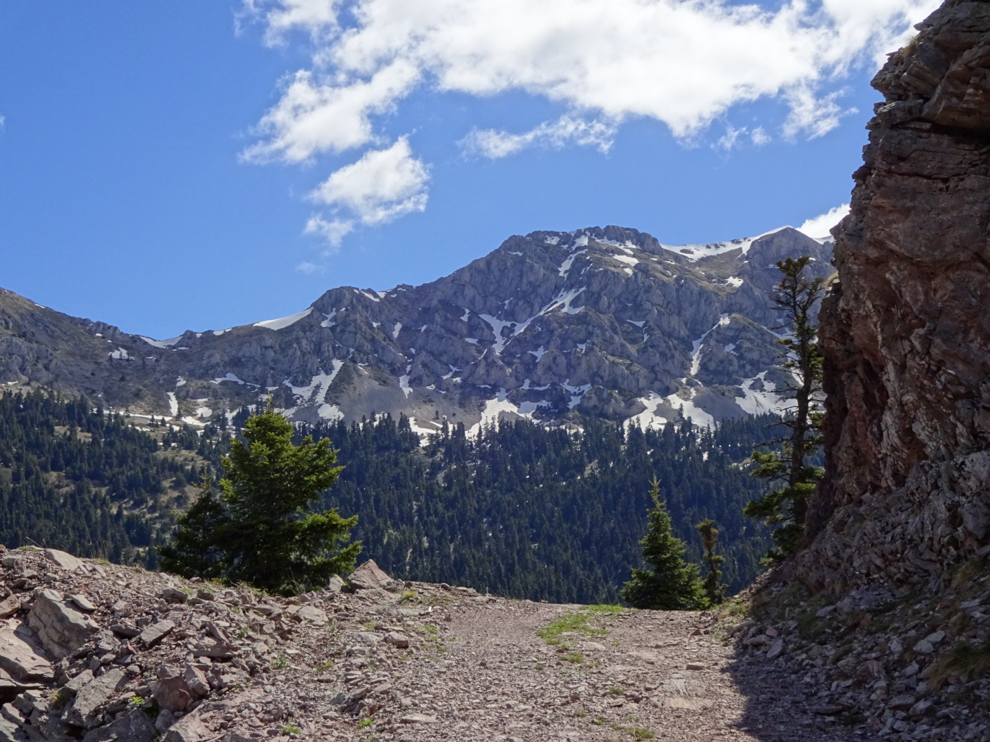
The Pindus mountains are not old mountains softened by age, their valleys rounded by ancient glaciers, they are sharp and pointed, with steep slopes and kilometre deep valleys, cut by boulder strewn streams and rivers. Little surprise then that each day on the E4 involves an ascent of a thousand metres or more, if you don't like walking uphill don't come here!  Below the snow, bare rock and high pasture, pine trees line the slopes, with holm oak and plane trees lower down. Red roofed villages cling to the mountainside, most houses closed when I walked through in late April / early May, while their owners earn their money in the cities of Greece. Patches of terraced, cultivated areas surrounded a few of the homes. Elsewhere goats, sheep and cows graze on small meadows of grass which somehow escaped the trees.
Despite the extreme landscape the E4 has plenty of easy sections along tarmac roads and forestry tracks. Its paths are elusive, I found myself bushwacking through the trees, sharp pine and juniper needles sticking into me. It's not like in Austria or Bavaria with well made and signposted trails and mountain top cafes where you can mingle with those who arrived by cable car or funicular railway. Instead there are remote churches high in the mountains in which solemn icons with gold leaf backdrops stare at you, or little shrines with oil and matches for the lamp inside, or a place for a candle, maybe commemorating some dead person, a hiker like you perhaps.
Despite all the holiday homes in the mountain villages, hiking, walking or trekking are not popular activities. Indeed on my trip I did not meet one other hiker, which perhaps explains the poor state of the paths. It could also be the time of year. Walking in late April and early May meant that snow was in issue above 1500 metres and especially over 1700 metres, this constrained my choice of route. It also meant that cafes and tavernas were less likely to be open. Despite being early in the year there were days when my tee shirt was stained with salt from dried on sweat. Climbing uphill in the summer heat would not be pleasant.
I camped in the woods on seven of the sixteen days it took me to cross the Pindus mountains from Kalampaka. Maybe with a bit more research and effort I could have reduced this number, there were signs saying ksenonas (guesthouse) in villages where I did not stay the night, complete with telephone numbers. But then if you ring them up it helps to speak Greek, English is far from universally spoken in this area. Wild camping also means that you can be more flexible where you stop, there are plenty of places to pitch your tent, with mountain views if you want them, with no-one ever knowing you were there, just the stars for company, barking deer to disturb you and the occasional drone of a plane in the distance. There were few shops open on the route and while I came with a good stock of food, I also relied on eating at tavernas on some of the days on which I was camping.
The mountains are beautiful, especially streaked with snow as I saw them. Purple crocuses and flowers of many colours, a chorus of birds, fresh, clean air, and friendly people (who paid for my coffee on more than one occasion) all make this a lovely place to walk through. Despite that, after 16 days of walking and 410 kilometres through beautiful trees and mountains every day, I was ready for my next landscape....

A GPX file of my route can be downloaded from wikiloc.com, or from myViewRanger short code johnpon0042.


Eptalofu to Delphi on the E4: Day 47

Walking on the ancient mule track down the mountainside into Delphi, with its atmospheric remains of classical Greece, was a major milestone of the trip.
The trouble with buffet breakfasts at a place like the Mavrodimos guesthouse, where they have an appetizing display of enticing edibles, is that you want to try a bit of everything from the rice pudding to the sheep's yoghurt to the three types of home-made jam. This makes your tummy a little heavy for climbing out of town!
A climb was certainly necessary to regain the mountains I was in yesterday, fortunately the route up, out of town was on dirt tracks through the pine woods, a lot easier than the fight down the mountainside to get into Eptalofu yesterday. The tracks continued for some time until I reached the point I was warned about by the owner of the guesthouse. The E4 climbs a path to the plateau of Kalania. He told me that the first 200 metres after the spring was difficult. It was the usual case of not being able to find a path, pushing through tree branches and climbing over rocks on my GPS track until I reached a small but consistent trail which climbed to the plateau with occasional E4  waymarks. The plateau was a flatish area of grassland with a few ploughed areas surrounded by trees, a bit unusual in such a mountainous area.
After the plateau a dirt track wound around the trees until the E4 took off on a more important path towards Delphi. This last section of the E4 towards Delphi seems to get more walkers, certainly the path was easy to follow. Leaving the pine trees behind it enters a noticeably dryer area and begins its descent into Delphi. No longer do tall pines cling to the mountainside, instead bush size Holm oaks and numerous brightly coloured flowers grow among the rocks. For this final descent the E4 is on a well made path with rough limestone blocks forming the edges and crude steps. The paths makes long sweeps back and forth across the mountainside as it slowly descends, so slowly you wonder if it will every reach the town of Delphi that I could see below me. There were tantalising glimpses of the stadium in the famous archaeological site where naked Greeks once raced. Finally in a profusion of yellow flowers I reached a road on the edge of Delphi and a little later booked into the Hotel Athina.
Although I had visited the ruins twice before I felt I could not leave Delphi without a brief walk up the sacred way to pay tribute to Apollo and the view from his temple, the tall yellow fennel growing among the ruins added to the beauty of the scene in the evening light.
Then it was dinner at one of the many restaurants overlooking the Gulf of Corinth and Itea, the town I will be walking to tomorrow. Before dinner I foolishly thought to compare myself favourably with the muscular marble torsos in the Delphi museum, but now I am looking and feeling distinctly pot bellied. I blame it on the bean soup....

19.8 kilometres walked today, with an ascent of 660 metres.

A GPX file of my route can be downloaded from wikiloc.com, or from myViewRanger short code johnpon0042.

Apollo's temple at ancient Delphi

One of the many types of brightly coloured flowers

Saturday, May 4, 2019

Kaloskope to Eptalofu on the E4: Day 46

A long and painful day crossing the steep and wooded mountains to Eptalofu. Painful as the blisters on my left foot were not to be ignored.
The day began early with a longish road walk passed old and not so old quarries to a pass. Some Googling indicates there are bauxite mines here (used to make aluminium) and even a museum. After the quarries I had a choice. The E4 officially goes up a dirt track and then a few kilometres of "path". Given recent experience I had my doubts about whether the path would be passable. Instead I had a GPS route from a blog by Stefanos Stamelou that went up a dirt track some way down the road which was visible on my maps, joining the official E4 higher up. Despite the extra 5 kilometres or so this route would involve I decided to take it, at least I knew it had seen recent use. Whether this was the right decision I do not know. On my way down the road I passed a petrol station with a cafe, hope of a coffee was dashed as I saw it was closed.
After walking down the road and climbing back up the vehicle track past goat pasture and into trees. I rejoined the official E4, there was no sign of the path it was meant to follow, although the undergrowth was not too thick beneath the pine trees so it may have been walkable. The vehicle track lead me to some high meadows, then another the E4 takes another "path" across a mixture of pasture, trees and rock outcrops. Flowers, spread across the pasture, were somewhat subdued by the intermittent rain. I was subdued by having to fight through trees and climb over rocks as I followed the route of the alleged path.
Another track took me a good distance around the side of the mountainside gaining height so that I could see the Peloponnese in the grey distance across the Gulf of Corinth, my next destination. Then I was engulfed by cloud as the track crossed a pass, reaching one of the many isolated mountain churches, complete with a full set of icons.
A "path" off the track, which I initially missed, took me down to Eptalofu. Although I spotted bits of paths in places, and even the occasional E4 waymark, really it was more of a routing that you follow with your GPS as best you can, down the mountainside, pushing through trees, stumbling over rocks and squashing plants and flowers. In the meadows lower down my treading on wild thyme gave the air a pleasant herby smell.
Tired and footsore I stopped at the first accommodation that had signs of life, the excellent Mavrodimos, which was a good choice with English speaking staff, heated rooms and reasonable prices. My dinner of locally produced lamb chops was really tasty. The square in the centre of the village was pretty lively, unlike the "suburbs" which had a number of half built houses.
I am now hoping my sore feet can make it to Delphi tomorrow.

33.6 kilometres covered today with a total ascent of 1120 metres.

A GPX file of my route can be downloaded from wikiloc.com, or from myViewRanger short code johnpon0042.

Quarries, maybe for bauxite

My first sight of the Peloponnese across the Gulf of Corinth

Friday, May 3, 2019

Athanasios Diakos to Kaloskope on the E4: Day 45

Roads, paths and forestry tracks took me through pine woods, passing two villages; the weather was fine and the birds were singing.
Leaving the village I was followed by a pack of dogs, maybe they thought we were off for a hunt. Fortunately after a kilometre or so they disappeared into the trees after some scent.
At the point indicated by my GPS track I turned off the road to follow the E4 down a path. As I was now expecting based on recent "paths" I had followed, in many places it proved difficult to find. This included a steep, slippery slope of deeply eroded gravel from which I extracted myself with some difficulty. My GPS was essential for guiding me back to a semblance of a path with rare E4 signs. On the plus side I came across a tortoise in my misadventures. Numerous prickly leaves from holm oak trees went down my back as I tried to push my way through to finally reach a river and the road bridge across it.
Here there was a choice. The most exciting alternative was to head over the Giona mountains and down a valley on the other side to the village of Viniane. However this meant going over 2000 metres and down a steep scree slope, which looked like it would be covered by snow. Given the snow was maybe icy and I was not equipped with an ice axe or crampons, I reluctantly decided to take the safer, lower altitude alternative via the villages of Strome and Kaloskope. To reach Strome I could have taken a path along the river among the trees, but given my recent experience I chose the quiet tarmac road, admiring the deep valley with its foaming river from above.
The cafes in the square at Strome were both closed, although there were signs that they had been open recently. I was not the only disappointed customer,  a pick up pulled in as I had a snack from my emergency supply, and quickly left on finding the cafes closed. The path around and out of Strome into the woods was at first easy to follow, so easy I lost my concentration and missed a turn. I retraced my steps to a point where the E4 follows a narrow path uphill beside a small stream. It then continued through woodland, the path often obscured by fallen trees; some searching for the path was needed at occasions.
In time it reached a forestry track on which I made faster progress to the village of Kaloskope. Alas, although there were two tavernas in this village, with evidence of being open recently (e.g. empty beer bottles) they were closed when I arrived. Supper for me would have to be tinned tuna and biscuits. As there would be a long day tomorrow in order to reach the village of Eptalofu, I continued walking for an extra couple of hours. The road and dirt tracks gave fast progress although there was one short section of "path", it's entrance guarded by six goats (?) with very impressive handlebar horns. The "path" consisted of fighting through undergrowth and tree branches following my GPS, although it did improve a little.
My feet were suffering, with blisters forming on my heels, when I stopped to camp beside a dirt track on a daisy strewn area of grass. I am now being confined to my tent due to the attentions of various small flying insects. I have only just recovered from the last crop of bits....

33.4 kilometres walked todays with a total ascent of 1010 metres.

A GPX file of my route can be downloaded from wikiloc.com, or from myViewRanger short code johnpon0042.

Prickly holly type leaves that get down your back as you push through overgrown paths, although its actually an oak tree

Plenty of scenic views, but too much snow to risk descending down very steep slopes

Thursday, May 2, 2019

Artotina to Athanasios Diakos on the E4: Day 44

The morning was spent on a barely discernable path clinging to steep slopes through pine woods and across scree, the afternoon was an easier walk mainly on dirt tracks to Athanosios Diakos.
I was somewhat apprehensive about the next section as a previous blogger (greekhiking.com) had slipped on a section of scree and injured himself. The path was faint and not easy to follow so I was very glad of occasional waymarks to reassure me that I was on the right bit of some slippery slope. In one place a waymark helpfully alerts you to an unexpected turn. I could have done with more as there was a bit of searching up and down the mountainside to find the path at times, but I was very grateful for those that did exist. The first section up through trees was not too bad, but then the path went around a mountain on a steep slope through trees, many of which had fallen and blocked the path, or else the path was blocked by saplings replacing the older fallen trees. In at least one section it looked like an avalanche had uprooted at whole area of trees. In places the "path" crossed loose rock and gravel and careful footwork was essential. There was also the odd section of snow to cross.
The path required a great deal of concentration so I was relieved to join the dirt track for the second part of the walk. (The track actually starts in Artotina so if you do not fancy the path I took, you can follow this dirt track instead). Climbing to a high pass above the tree line, with snow covering the track in places, I gained a dramatic view of the mountains around me, streaked black and white with the snow.
After the pass it was downhill along the track, with sections of path in places cutting out some of the loops. A bit depressing losing all the hard won height I had gained, but I finally reached the village of Athanasios Diakos.
In the central square with the church, plane trees and tavernas, so typical of Greek villages, I enquired about accommodation and was soon having a shower in one of the "rooms" nearby, arranged at the Ravanis taverna. Dinner (meat and rice wrapped in cabbage) followed. After dinner I wandered around the village, decorative lights were hung up from some lamposts, and there was a path from the square took you to a pretty valley. No sign of a shop though which would have been useful as my supplies were low.
There is a sign in the square with a map of the E4. It states that tomorrow's walk has an ascent of 85000 metres, so I better get a good night's sleep!

17.8 difficult kilometres walked today over 8 hours, with a 700 metre ascent.

A GPX file of my route can be downloaded from wikiloc.com, or from myViewRanger short code johnpon0042.

Spot the path!

Heading towards Athanasios Diakos

Approaching the pass

Wednesday, May 1, 2019

Ambliani to Artotina on the E4: Day 43

Mainly a day of road walking so a faster pace than yesterday.
Several rock falls and fallen trees blocked the dirt track I was following up to the village of Mandrine. Fortunately I was able to follow a path across these obstacles made by some helpful cows and reach the very quiet village. Only one house had smoke coming from it, the rest had their shutters firmly closed. The cafe beside the church had been shut for some time so I had a snack from my stock on one of the benches in the adjoining square. I followed the road, initially on gravel and later tarmac, to the village of Leyka, which was similarly shut up, and on to Grammene Oxya. Only one car had passed me on this section (with a dog following it).
Diverting into Grammene Oxya, impressed by its long name, I found a cafe open in the central square, beneath the typical plane trees. An English speaking customer helped me order some coffee, sweet Easter bread and biscuits. He confirmed what I had been told yesterday, that the houses in mountain villages like this one were only occupied in the summer, with only 5 or 6 people living in this village all year round. He also paid for my coffee in a kind gesture.
I continued along the winding road, now slightly more busy, stopping to visit a monastery. It no longer had monks but some workmen were doing some restoration work on the paths. One of the them offered me a cube of Loukoumi, the Greek version of Turkish Delight, and poured me a drink from a mineral water bottle to accompany it. I drank, mistakenly thinking it was water, but of course it was some spirit, maybe tsipouro. However it went well with the Loukoumi.
Some kilometres later I arrived at Artotina, a slightly bigger village, ready for a late lunch, which I ate at a cafe in the typical main square - pork in red sauce with fried potatoes and tsatziki. A caged bird tweeted in the background while I ate.
A couple who stopped their car as I was walking said there was a hotel in Artotina, however, tomorrow's walk looked difficult and I expected slow progress, so I pushed on for a few more kilometres. After walking down to the base of the valley it was up a barely discernable path on the other side. Reaching a promontary with some flat ground (not so common in the Pindus mountains) at about the same height as Artotina, I made camp for the night. Black clouds are gathering as I write this.

30.2 kilometres walked today with a total ascent of 1270 metres.

A GPX file of my route can be downloaded from wikiloc.com, or from myViewRanger short code johnpon0042.

View from road

Road to Artotina

Inside church of Monastery Agiou Ioanni