Friday, June 7, 2019

Archanes to Kastelli on the E4: Day 80

Another day among vineyards and olive trees, during which I walked over hills, across a steep valley and up a gorge.
After saying goodbye to George, the landlady's little son, I climbed out of Archanes and over a hill. There were some road works, wineries, olive groves and half built buildings with rebar sticking out of the roofs. With all the vineyards I was not surprised to read on a sign that this area produced most of Crete's labelled wines (as opposed I suppose to the wine they pour from plastic bottles originally used for mineral water). As I passed individual fields of vines I often saw a lone person doing a bit of pruning of the new bright green growth, on one occasion accompanied by their dog who rushed after me, teeth bared and barking furiously. The lady called it off after hearing me desperately shouting at the dog to clear off while I pirouted to defeat the dog's planned attack from my rear.
After the village of Kounavi the route was down a very steep dirt track into a narrow valley. At the bottom I clambered down over dirt and grass and rocks to a narrow path at the bottom from which I found a rickety bridge among the bamboo. Without a GPS I doubt I would have located it. After climbing onto a field on the other side I joined a track that led me up a steep slope to Myrtia. This village is home to a Nikos Kazantzakis museum. Many years ago, on my previous visit to Crete, I read "Zorba the Greek" and struggled to finish it or keep a grasp on the plot, so decided against a tour of his museum although a TUI minibus was bringing some visitors.
After Myrtia a dusty dirt track, with a sign saying canyon, descended to the bottom of a valley, a stone bridge and the start of a gorge. On walking down to it, the gorge is almost invisible, hidden by the folds of the landscape. Only at the stone bridge can you look up the gorge, and even then it is longer than it appears. I followed the small path, marked by two red stripes. A stone aqueduct, now devoid  of water, must have once powered a water wheel. Water is now absent from the gorge, maybe piped away for the irrigation used to keep the vines green. At times the path is easy but soon there are difficult sections, overgrown and rocky. Cliffs rise on each side of the path. There are plenty of waymarks, but I still had to try two or three possible routes in places to find the next waymark, pushing past branches and through tall grass, thistles and other plants. After what seemed a lengthy period of struggle the path climbed up the side of the gorge in a gap between cliffs, rising to a viewpoint and then on through olive groves to a road.
Tarmac took me to the Angarathos monastery with its atmospheric church, the light coming through coloured glass in the dome, paintings of saints all over the inside. Some time after this the Cretan Way trail takes you into a field with tall oat grass, thistles and absolutely no sign at all of a path. Having struggled enough with the undergrowth today, I returned to the tarmac and followed an alternative route by road to Kastelli. A lengthy walk, but one shaded by eucalyptus trees after the village of Apostoli. I passed a 14th century church with an unsympathetic concrete roof. Inside it was rather bare compared with many such places, no iconostasis although the usual lectern, lamps etc. are there. Yet as my eyes adjusted to the darkness I begin to see the faint outline of paintings of saints on the wall.
Tonight I am staying at Hotel Kalliopi. It feels as if I have no padding beneath the bones of the ball of my feet, and my right ankle is tender around the Achilles tendon, so I have decided to spend two nights at Kastelli to give them some time to recover. After dinner at one restaurant I ate a large slice of lemon cake with a cappuccino at a second place called "Sweet things". Now I am feeling very fat...

24.9 kilometres walked today (excluding trying to find a path) with a total ascent of 660 metres.

Looking for the path at the bottom of the Karteros gorge

Looking back at the Karteros gorge

Church dome at Angarathos monastery

Road to Kastelli

Thursday, June 6, 2019

Kato Asites to Archanes on the E4: Day 79

A walk in the sunshine passed vineyards and olive groves, the low hills hiding some steep slopes.
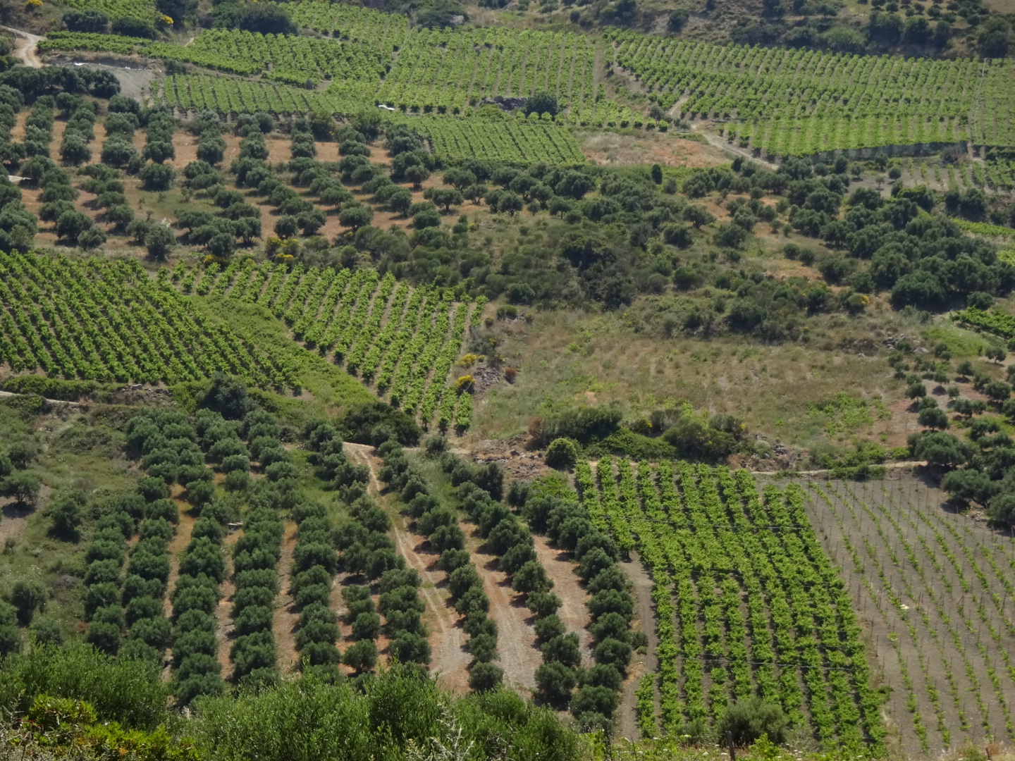
Looking across the valley while eating my generous breakfast at Asion Lithos it looked like my walk today would be over low hills, however these hid some steep slopes and big climbs. According to my GPS over the day I climbed over a 1000 metres. My walk was through an agricultural area. From a distance the hillsides looked like of jigsaw of fields of vines, olive trees and bare earth, all draped around rocky outcrops. The lines of vines and olive trees had a pleasing regularity bringing order to an unruly landscape. Higher ground had its usual cloak of scrubby vegetation.
I went through a number of villages: Kerasia with its little alleyways, Kiparisos where I enjoyed an ice cream with an old gentleman who was trying to converse with me (he had no English and I had no Greek so not entirely successful) and after the climb to the village of Profitis Ilias I needed a cold drink.
I passed the Palianis Nunnery enroute with its restored church (locked when I was there) and sacred tree, which had silver tokens on, which I presume indicated where people needed some prayers answered. At one point I had to cross a drainage ditch, the water covered with green slime, fortunately I managed to stay on the stepping stones! The 350 metre climb late in the afternoon was hot and sweaty. On one side of the ridge I could see the snow lined peaks of the Psiloritis mountains I had crossed a few days ago, the other side I could see the mountains I would cross in a few days time.
Tonight I am staying in Archanes, a place with an old area with little lanes to get lost in, from before the age of cars. I found the door to the Troullos traditional homes where I am staying. It opened into a courtyard off which there are a couple of rooms and stairs up to a larger courtyard with more rooms. I had a 3 room affair all to myself with old taps and photographs to match the old buildings.
Later, in the village square where I have just finished my meal, people are riding up and down on motorbikes, scooters and ATVs, nobody wearing helmets of course, men and women alike. Kids are doing "wheelies" on their bicycles, tourists wander around wondering which taverna to frequent and a lady opposite is trying (in vain) to encourage some amorous response from her husband(?). He is wearing a Givenchy tee shirt, I look it up on the web and am shocked at the price, but maybe it's not genuine. The fumes from passing cars are not so pleasant but the food is good and they have given me some ice cold raki and desert.

26.3 kilometres walked today and a total ascent of 1050 metres, the owner of my accommodation said I looked tired!

Regular patterns in fields

Wednesday, June 5, 2019

Psiloritis mountains to Kato Asites on the E4: Day 78

A walk through the mountains ending in a long downhill path.
An avian choir woke me early so I packed up and decamped while the sun was still below the mountain tops. The snow on which I was pitched was soft and crystalline yesterday, this morning it was hard, icy and slippery. The rocks I had placed on the pegs to keep them secure had become iced into position, I used another rock as a hammer to free them. I had to carefully pick my way down the valley over rocks and thorny bushes. High above me a shepherd was already herding his sheep, and they were making faster progress down the mountain than me.
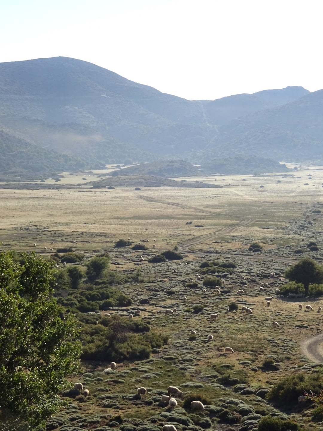
At the bottom of the valley there was a small family church, some informative signs and what might one day be an information centre. Beyond all that was the Nida plateau, a flat area of grazing land. It was here I saw a goat grazing on the top of a tree, the tree's stunted shape, trimmed by the goats, had made climbing up it easier for these animals.
My way led along a dirt road, out of this plateau and into a series of smaller flat areas. Each of these was surrounded by higher ground, the track climbed out of one and descended into the next, there was no river draining them, it was a feature of the limestone landscape. On these flat areas there might be a pick up or two, a small building, a fenced area, and sheep being corralled and put in the back of pick ups.
The dirt track ended and the route followed a "path". As I was beginning to expect, the path was difficult to spot. The one I wanted headed around the mountain. I followed the route on my GPS among the rocks, trees and thorny bushes. It led me to the top of a steep, rocky drop. I needed to get down but it was difficult to see how. I scrambled down the rocks a little but due to the convexity of the slope I was unable to see if there was a sheer drop beneath me or not. Recalling the advice I received on a scrambling course at Plas y Brenin I followed a route marked by brown staining on the rocks. The brown staining on the rocks could have been caused by mud carried on the boots of people before me, or it could have been mud carried by goats. In the event it led me down to the more gentle slope below, however I would not recommend others to come the way I did, although I was always close to the route I downloaded, and a footpath marked on the Greece Navitracks map on my GPS. It may be that the route I had was outdated, as some red markings and a sign I later came across suggested an alternative had been developed from the Nida plateau, to the north of my route on vehicle tracks.
The path joined a dirt track and then a gravel road cut into the rock which took me around a great bowl in the mountains. Above was mainly naked limestone, below, what passes for a forest in Crete  composed mainly of holm oaks. I could see an eagle circling. The E4 route across the Psiloritis mountains that I was following was probably not the most popular. An alternative took you down to Zaros. Both routes joined at a point where a path heads up to a pass at some 1700 metres. Again the word "path" was a misnomer, I just had to pick a way through the rocks, thorn bushes and, lower down, trees, up a valley in the general direction indicated by my GPS. In places steep rock outcrops required some thought on how to get around them. As I climbed higher there were occasional waymarks, red stripes or spots, or E4 signs on posts, usually positioned high up on rocks. At first I thought the path went close by the E4 signs, but in many cases the path was a many metres lower down, the sign cemented into a high rock presumably so it could be spotted from a distance.
On reaching the pass at around 1700 metres I thought I would have enough time to get down the other side to some accommodation at Kato Asites and phoned to make a reservation. I was finding the steep, rocky and thorny slopes of Crete made it difficult to find a good camping spot, making a more conventional bed desirable. However having reserved a room I felt under some pressure to get there at the agreed time. The distance was not great but the path was very, very slow. It involved descending some 1200 metres in a short distance over a rocky landscape. Loose or wobbly stones meant you have to take it slowly and carefully, and my feet were complaining about all the hard work they had been made to do in the last two days. I was glad I had stiff boots as even with these the soles of my feet were feeling the rocks trying to push through my soles into my feet. Towards the bottom I was getting frustrated with the interminable descent. The first milestone was a refuge, but the more gentle slope it occupied did not last long, there was a steeply dropping gorge section ahead, fortunately with some helpful waymarks and a slightly clearer path. While the descent was frustrating, this is not to say that the scenery, the limestone outcrops and flowers were not attractive, even beautiful. I was nevertheless relieved to walk into the village of Ano Asites, and hence to its sister, Kato Asites, where I am staying at the spacious Asion Lithos apartments, where I received a welcome discount for having read about it in the Cretan Way guidebook. A shower, a beer and dinner greatly improved my mood.

29.8 kilometres walked today, with some difficult terrain, and a total ascent of 800 metres, although the total descent of 2250 metres was the more painful.

Nida plateau

Rouvas forest

Rocky path doen to Ano Asites

Tuesday, June 4, 2019

Fourfouras to the Psiloritis mountains on the E4: Day 77

A massive amount of climbing to reach Timos Stavros, the highest summit in the Psiloritis range and at 2456 metres the highest point in Crete, snow added to the difficulties.
The "Windy Place" taverna kindly made me an early breakfast at 6:45 am, so I could make a start on today's enormous climb in the cool of the morning. Being west facing the mountainside was also in shade as I started, so I made a good start on the 2000 metre or so to the summit, before the sun heated things up. Early on I missed a few turnings on the dirt tracks I was following, as I watched the sun colour the mountain of Kedros on the other side of the valley.
After olive trees, gates and herds of goats on terraced pasture my route headed up a path which rose steeply through stony ground with scattered thorny oaks. I met the Austrian party among the oaks. They pointed out a path to the last spring this side of the summit, where I went to top up my bottle, admiring the views on the way. Not long after we met again at the (locked) mountain refuge. After that it was a steep climb over rocks with the usual low thorny bushes, releasing aromas of thyme and sage as I walked. Waymarking on this popular section was very good, which helped to pick the correct path among the many created by sheep and goats. Patches of snow interrupted my passage, not so easy to negotiate on steep slopes. Most I could walk around. On one large patch, someone had laid out a lengthy fixed rope over the snow, with loops so you had something to hang on to if you slipped. Eventually I arrived at the summit of Timos Stavros, where a small chapel has been built out of the loose stone covering the mountain. I was fortunate there was no cloud, unlike yesterday, so I could see the sea both north and south of Crete, the White mountains to the west, and the remainder of the Psiloritis mountain range to the east. Too hazy though to shoot decent photographs.
Coming down after some lunch and admiring the view, I was following a different path that would take me the length of the mountain range. This traversed the very steep northern slope of the adjacent mountain, called Angathias, and unfortunately the northern side of the mountain was completely covered with snow, despite it being June. It would be far too hazardous to cross. Instead a couple coming from that direction told me they had avoided it by climbing up and down Angathias on snow free areas. So I headed up towards the summit of Angathias and worked my way around to find a snow free ridge down. Not easy as snow often lay out of sight hidden by the convexity of the slope. I continued over higher ground rather than attempt the alternative route down a snow filled valley. I had to cross a few patches of snow but none where the slope was steep. On some patches of snow there were pieces of rock covered with lady birds, their presence here was a bit of a mystery to me. I passed a "mitata", a hut made entirely of loose stone found on the mountain, once used to make cheese by shepherds as it kept longer than milk so allowing time for it to be transported to market, although the hut seem rather small for this purpose.
My legs were tired and I started thinking of where to camp. The Cretan Way guidebook suggests using a certain sheep fold, but it was off my route, and from a distance (and in my mind giving the likely amount of sheep excrement) it did not look appealing. Instead I headed a little way down the valley I would be following tomorrow. Like the rest of the mountain it was not very suitable for camping. Even if I could find a flat area large enough for my small tent numerous rocks and / or thorn bushes prevented me pitching it. Instead (after due consideration of avalanche risks) I flattened a suitable piece of snow and camped on that.

I walked 18.9 kilometres today, not always by the most direct route due to the snow, and climbed an amazing 2245 metres.

Path up Psiloritis range to the highest peak of Timos Stavros

Chapel on top of Timos Stavros, the highest point on Crete

Sheep on the snow

Camping on the snow (in June), at least it has no thorns

Monday, June 3, 2019

Gerakari to Fourfouras on the E4: Day 76

Apart from an overgrown path, an easy day passing through a few villages.
Leaving Hotel Alexander after a good breakfast, I pass one of the old white minis (the car not the dress), a nostalgic exhibit it seems to accompany other diverse artifacts at the hotel, like pictures of different knots. After a walk along a road passed cherry orchards to the sound of a flock of sheep somewhere I soon reach the first village of Elenes. The next section is one of those overgrown paths through low thorny bushes, thistles and sage plants, where I followed red waymarks (somewhat confusing at one place), my GPS track and my nose in an attempt to work out where I should be going until I spot the Austrian group ahead of me. This makes navigation easier (having done the route 20 times must make it easier to find). On reaching a road I pass them on some detour dictated by my GPS which avoids a few hundred metres of road. We meet again while I am having coffee at a cafe in the next settlement of Amari at the bottom of a cobbled path. The bell tower looks impressive but the sign says it was built at the beginning of the century, so not so old.
On my way to the village of Lambiotes I try to follow the detours off the tarmac indicated by my GPS, following dirt tracks among the rocks and bushes. On the first one a padlocked gate, with a sign warning of a guard dog, forces me to return to the road. I am more successful on the second one which delivers me to Lambiotes. I keep passing small Orthodox chapels, each with the same design and interior fittings: an iconostasis (a screen hiding the alter with icons on), a lectern, a place to burn candles, a lamp or two and some icons and maybe wall paintings. The paintings of Jesus, Mary and the saints always look so solemn, today in particular they seemed to be frowning.
After Lambiotes it was down a valley, a tricky water crossing, then uphill to Fourfouras. I passed some old ruins: an arch and a section of aqueduct. A later sign indicated somewhere nearby there were some Byzantine ruins of a Christian church. I reached Fourfouras walking up through an old part of town where the houses were almost built on top of each other. Tonight I am staying at the "Windy Place", the Psiloritis mountain range I hope to cross in the next few days is apparently quite breezy. My GPS gave me the position of the rooms, but when I arrived they were all shut up. I had no phone signal to call the owner so I asked a few people and finally reached the Windy Place taverna which is at a different location to the rooms. My delay in finding the place meant that the Austrian party arrived first and were already enjoying a cold beer. I guess enthusiasm must bow to experience!

17 kilometres walked today with a 460 metre ascent.

Path after Elenes, catching up with the Austrian party

Blocked route

Byzantine remains?

Sunday, June 2, 2019

Spili to Gerakari on the E4: Day 75

Up and over a mountain having to make one's own path for much of the way.
A sign on the village said that today's walk would take 7 1/2 hours, so I decided on an early start to enjoy the cool of the day, knowing that much of it would  be uphill. This meant no breakfast at the Heracles rooms as it did not start until 8:30 am, instead it was coffee in the village soon after 7:00, with some pastries with feta cheese inside.
The initial section was a climb uphill on a track away from the main road followed by a walk downhill back to the same road. I passed a couple of men organising their sheep and a pick up full of barking dogs but otherwise it was just a means of avoiding the main road for a while.
A little further on, after a faded E4 sign, a track headed uphill to the village of Kisos. The hillside on the other side of the valley had expanses of yellow from the broom in flower. Kisos had an old church dedicated to St John with 13th and 15th century wall paintings of the saints and the like, faded and a little damaged but still visible once your eyes were accustomed to the darkness of the church. At the church I met a party of E4 walkers from Austria, their leader was walking the E4 in Crete for the 20th time, the second such group I had come across where one of their number was on their 20th trip.
Climbing out of the village the vehicle track ended and the GPS indicated that I should continue on a path. Sadly there was no evidence of any path on the ground. It was a matter of pushing through low thorny bushes in the direction indicated by the GPS. I quickly converted my shorts to trousers to avoid being scratched. The non-path led me to a typical Cretan rebar fence. There was no obvious way through it, a major disassembly would be needed, undoing the wires attaching one section of fence to the next. Instead of this I followed the fence uphill thinking there must be an easier place to break through. There wasn't. Having climbed up so far and there being no visible path on the route indicated by the GPS I decided just to head straight up the side of the mountain to the pass that the path was meant to take me to by a less direct route, but with more gentle gradient. My climb began well crossing a fence where someone had created a low point, and marked it with a red spot. Above that there were piles of stones and old farm terraces. Above them the slope became quite steep. I aimed for an area without cliffs and continued to climb, at times requiring use of my hands. It might have been a pleasant climb among the limestone blocks and vegetation but thistles and other plants equipped with sharp thorns meant my hands were at constant risk of being stabbed. I could see the Austrian party in the distance below me sensibly sticking to the route indicated by my GPS, "making their own path" but I eventually reached the pass on my more unconventional approach.
I continued along the top of the ridge to the west admiring the birds of prey slowly circling and the views opening up before me of the White Mountains, the sea and the route I had walked yesterday. A further fence discouraged me from reaching the high point ahead of me, so I returned to the pass and headed down a track, before turning up a valley where again the mapped path was absent. Near the top of the valley I joined a vehicle track that led me down towards Gerakari. I did not take exactly the route shown on my GPS as large padlocked gates and tall fences topped with barbed wire prevented this, but there were other tracks to walk down.
I stopped at the first cafe in the village for a Coke, hoping to catch the Austrian party as they came passed and ask them some questions about the future route. There were several grey haired, unshaven men arguing about something and drinking raki or white wine. As they had some small plates of food, I asked for some also, but the waitress said it was just for them. Nevertheless after a short while she appeared with some...and then some more, including some cherries for which the area is apparently famous. Then the men started buying me shots of raki! When I left the waitress refused any money for the food, saying it was from her. I was most impressed by the undeserved kindness given to me  especially as there was little opportunity for me to repay it.
I am now at the Hotel Alexander. Its pool had looked very inviting when I arrived, so after checking in I swam a few lengths then lay on a sun lounger. Unfortunately a cold wind made my sun bathing a rather temporary exercise, so instead I checked on the route I took today. It seems that up to four routes have been published for this section. One, on the Cretan beaches website and a sign in the village directs you up to the peak of Analipsis, some 770 metres higher than I reached today...I was a bit disappointed as it looked a good rocky mountain and I had plenty of time.

14.1 kilometres completed today with a 825 metre total ascent.

Wall paintings in 13th to 15th century church of St John

Path near the path where it was more defined

Yellow broom beside the track, the Psiloritis mountains are in the background

Saturday, June 1, 2019

Argiroupoli to Spili on the E4: Day 74

Wooded valleys, low mountains and a plain today, a change of scenery compared with recent days.
As I was planning a longish day I started out at 7:00 am, walking in the cooler morning light up and down wooded valleys on roads and dirt tracks. Of special interest was the abandoned village of Nisi. As I climbed up the hill approaching it I noticed the old terraces, constructed with big white boulders to trap the meagre, dry earth. The terraces, constructed with much effort, now used only for goats, the abandoned olive trees competing with holm oak and other species. Aside from a small building roofed with corrugated steel, there were no houses still complete, only walls and piles of masonry. Some of the old entrances had arches, making it appear that their owners were once wealthy. Now the village was occupied by goats who stared at me, and a flock of sheep, heading along the track to some appointment, unguided by any shepherd or sheepdog, and only slightly hesitant about my presence.
A cobbled path led me up to the village of Mountros where I stopped for my breakfast cup of coffee, served with some sesame coated shortbread. After the village I climbed out of the valleys, through some olive groves and onto hills, which were either covered with the typical low scrub of Crete or by farmed patches of wheat, draped over the landscape. Thistles in purple bloom lined my track.
The Cretan Way, the guide to the E4 in Crete and the source of many of the GPS tracks I was following, takes you to Agios Ioanis and Kanevos, however as I wanted to reach Spili today, I took the shorter E4 route shown on the Harms IC Verlag map of Western Crete which goes via Agouseliana, rejoining the Cretan Way route at Koxare. E4 waymarks had become very rare since Hora Sfakion so one has to rely on maps, GPS's and guides, although the Cretan Way route is at times marked by two red stripes. On my route via Agouseliana I actually spotted two rare E4 waymarks. The road I was following was very quiet, only a couple of pick ups and a flock of sheep being herded by a man on a moped busy talking on his phone.
After the village of Koxare there was a brief period on a busy road so I was glad when my GPS indicated to turn off onto a path. Sadly, calling it a path was too generous a description. I pushed through tall grass to where the "path" crossed a small river. I found a place upstream that I could cross without flooding my boots but it was a struggle to get to the farm track that formed the next part of the route, a Cretan rebar fence not helping. After Agouseliana I had been walking mainly through olive groves. Some of the trees had been left unattended, and without pruning had grown to a considerable height.
After lunch at a cafe at Mixorouma, it was only a few kilometres more to reach Spili, on a route desperately trying to avoid the main road. I am staying at the Heracles rooms just off the main street of the town. There are lots of tourist shops, tavernas and cafes. Although tempted by a cold beer, I was very good and had a No. 4 smoothie at one (I had a beer later!).

29.2 kilometres walked today, with a total ascent of 930 metres.

A house at the abandonned village of Nisi

Goats at Nisi indicating it was now their village

Old cobbled path up to Mountros

Hay or Wheat fields